Incoprea · An illustrated history
The World We Lost: 30 Wonders That Vanished

A white temple rises above an ancient plain. Canoes move through a lake city. Houses gather into an inhabited cliff, while another generation builds a miniature tomorrow inside an enormous sphere. These thirty wonders belonged to people’s working, sacred and everyday worlds. Some buildings disappeared; others survive as ruins, fragments or profoundly changed places. Archaeology and archival records give us anchors for the journey, alongside clearly identified AI-assisted reconstructions that imagine lost settings without turning interpretation into documentary evidence.
01Treasure Island's Vanished Fair
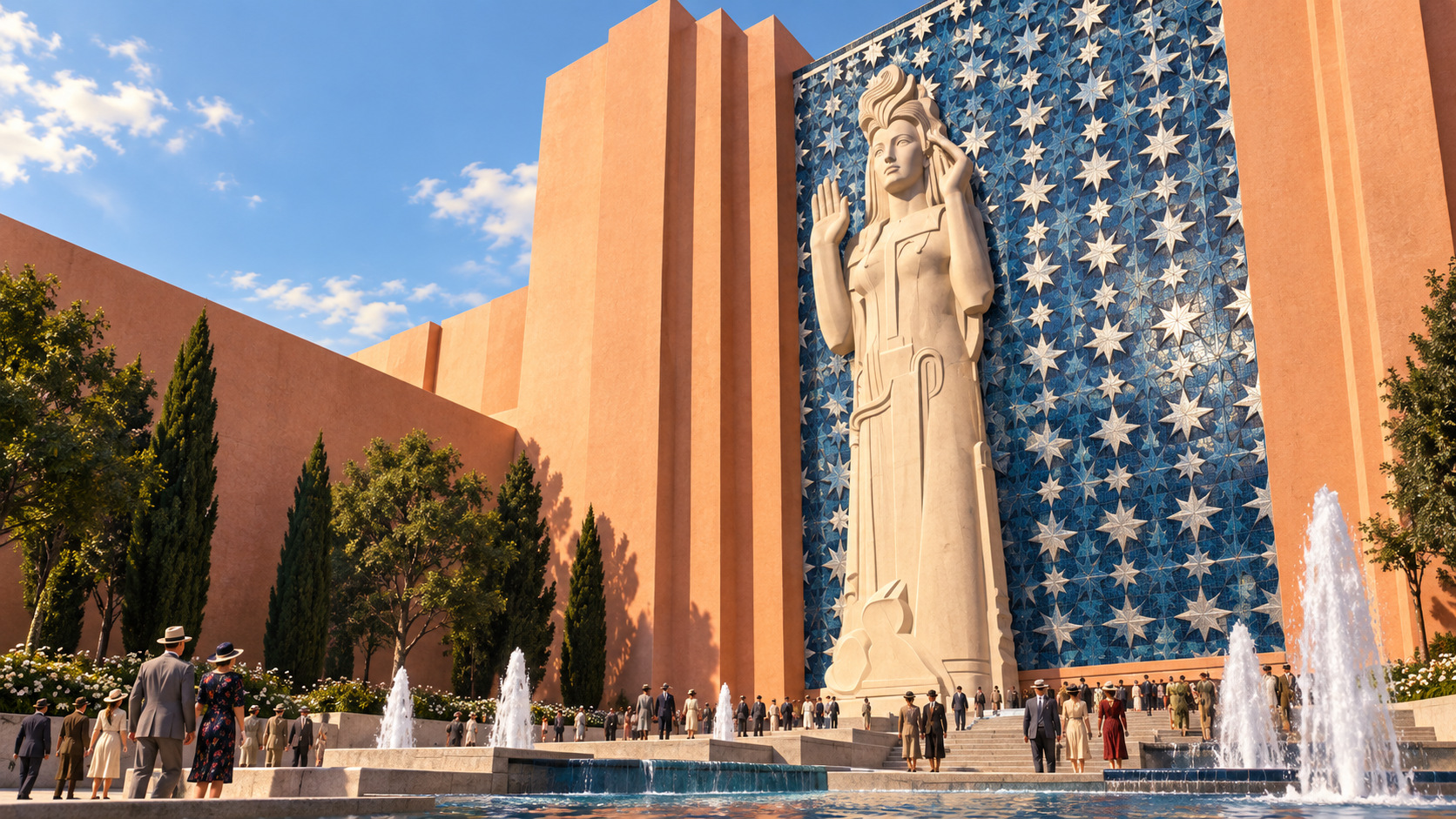
On an artificial island in San Francisco Bay, visitors entered a temporary world of colored courts, monumental sculpture and carefully composed vistas. The Golden Gate International Exposition opened in 1939 and returned for a second season in 1940. Its Tower of the Sun supplied a vertical landmark, but Pacifica offered a different kind of encounter: an enormous female figure set against a patterned screen. [P1] [P4]
The sculpture belonged to the fair's attempt to imagine a shared Pacific future. That ambition should not be confused with an accurate reconstruction of any single culture. Buildings and decoration combined influences selected by the organizers, turning a varied ocean region into an exhibition vocabulary. Pacifica's size, the surrounding stepped forms and the screen behind her created a deliberately theatrical setting for visitors approaching on foot. [P1] [P4]
Lighting extended the spectacle after sunset. Contemporary architectural reporting and the museum's historical record describe the fair as an environment to be experienced through changing color and illumination, not simply a collection of facades. A surviving Tichnor Brothers postcard preserves one period presentation of Pacifica. It is a colored linen-texture print, not an untouched color photograph; its stylized finish belongs to the fair's visual afterlife. [P1] [P5] [P6]
After the exposition, the Navy took over Treasure Island and most of the temporary ensemble disappeared. The island did not vanish, and three permanent main exhibition buildings remain important witnesses to its earlier use. What is lost is the connected experience: the approach through festive courts, the monumental figure, and the lighting that made a newly built island feel like another world. This was the 1939–1940 fair, not San Francisco's different exposition of 1915. [P1] [P2] [P3]
02The Silver Tree That Served an Empire
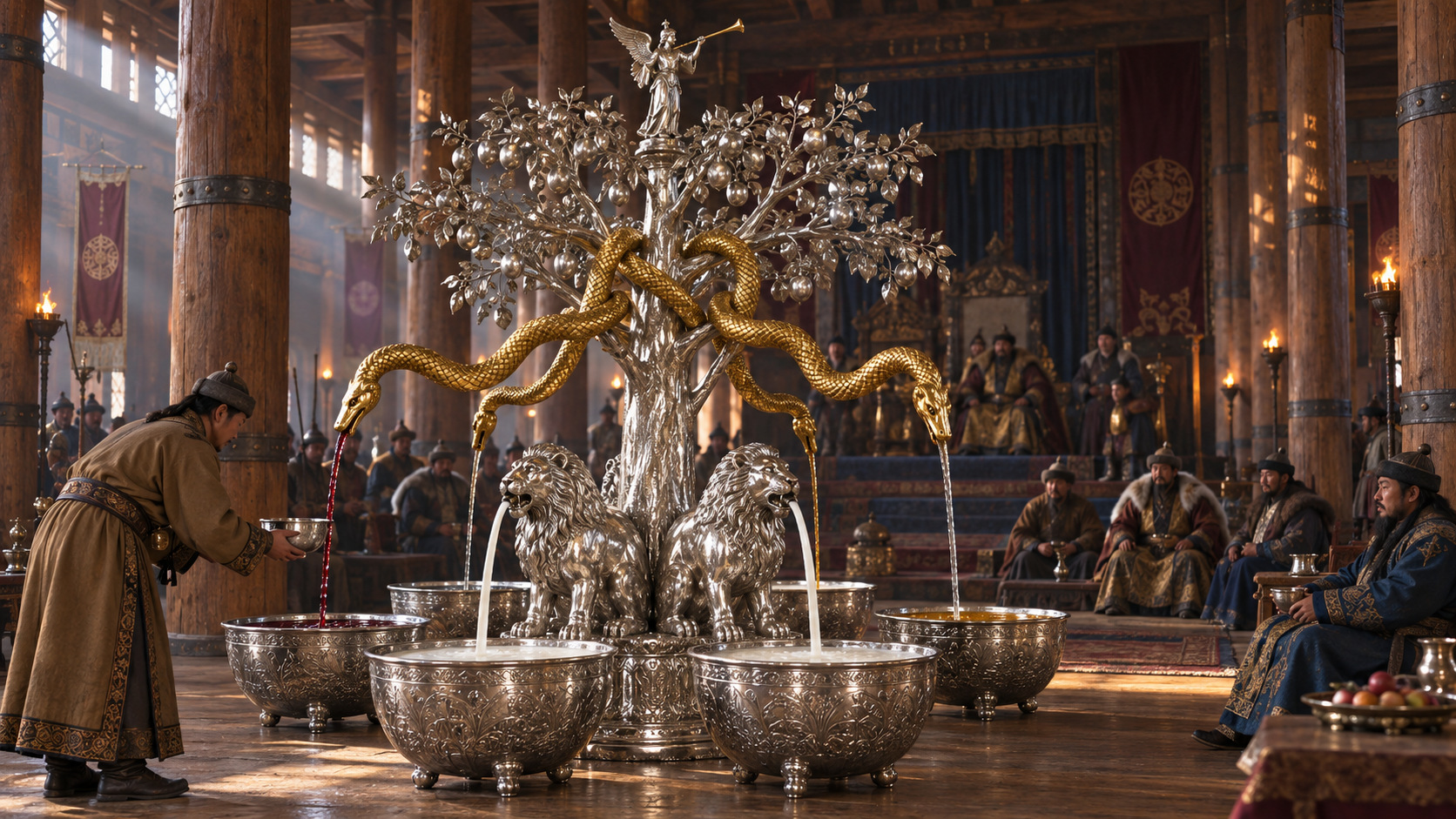
At Karakorum, even serving a drink could become a demonstration of imperial power. William of Rubruck visited the Mongol capital in 1254 and described a silver tree inside Mongke Khan's palace. This was no miniature table ornament: he reported that the tree and its receiving bowls occupied a considerable part of the hall. Its silver branches carried leaves and fruit, while animals and an angel turned plumbing into sculpture. [K1] [K2]
Four silver lions stood at the roots, dispensing mare's milk. Four separate pipes rose through the trunk and curved downwards, each accompanied by a gilded serpent with its tail winding around the tree. These supplied wine, clarified mare's milk, a honey drink and a rice drink, collected in separate silver bowls. Rubruck's account makes the arrangement wonderfully specific without supplying a complete design or a reliable height. [K1]
Above them, an angel held a trumpet. Bellows had failed to provide enough air, Rubruck explained, so a man concealed beneath the tree blew through a pipe instead. The signal prompted servants outside the palace to pour drinks into the conduits; attendants then carried them to the guests. Beneath the glittering display was coordinated human work, including the ingenuity of its maker, the captive Parisian goldsmith Guillaume Boucher. [K1] [K2]
The original fountain is lost, and its final fate is not securely known. Karakorum's archaeological remains survive, but no recovered tree establishes its exact appearance. Its exact proportions and the angel's internal mechanism still require interpretation. The eyewitness description preserves something equally memorable: a brilliant performance whose effect depended on people the audience could not see. [K1] [K2] [K3] [K4]
03The Palace of Electricity
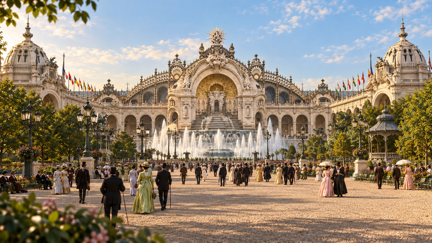
Paris, nineteen hundred. Water tumbles down an immense sculpted facade, while thousands of electric lights turn its crest into a crown of fire. This is the Palace of Electricity and its Water Castle, built for the world's fair. Behind the spectacle are the machines supplying power to the exhibition. The palace is both a promise about the future and part of the machinery making that future visible. Yet this extraordinary ensemble was temporary. The fair ended, and the palace disappeared. Look at the people in the photograph. For them, this was simply a place to spend an afternoon.
Eugène Hénard designed the electric palace; Edmond Paulin designed the Château d'Eau in front. CNAM describes 4,200 lamps in the decorative crest, a figure that should not be confused with a count of every light across the exhibition. These were working exposition structures, documented in construction drawings, technical reports and photographs. The two connected buildings are counted here as one wonder. The cover is an illustrative reconstruction of their atmosphere; the accompanying archival views are separately credited.
04The Bedroom That Opened onto a Painted City
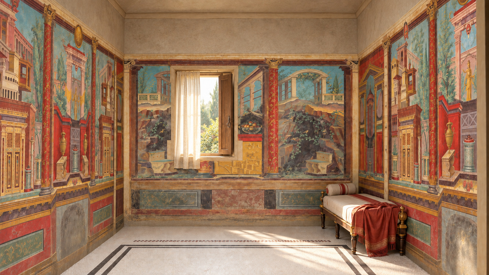
Imagine waking inside a room whose walls offer more space than the building contains. Slender columns frame distant terraces, enclosed courtyards and elaborate gateways. A rocky landscape opens at the rear, with a grotto and fountain. All of those inviting distances belong to a painted world. The bedroom itself remains a bounded, intimate space. [B1] [M1] [M2]
This is archaeological room M from the Roman villa conventionally known as that of P. Fannius Synistor at Boscoreale, near Pompeii. Its frescoes, dated by the Metropolitan Museum to about 50–40 BCE, are a spectacular example of the Second Style. Artists used architectural perspective, overlapping forms and painted shadows to make the walls appear permeable. The grandeur lies in their illusion, not in actual golden columns filling a bedroom. [B1] [B2] [B3]
The room rewards a slower look. Its side walls pair architectural prospects with matching compositions, while the rear includes a bowl of fruit balanced above a miniature landscape. Scale shifts continually: a private sleeping place seems to borrow the reach of a town. We cannot identify every painted building as a real destination, or supply the bedroom's original furniture with certainty. [B1] [M1] [M2]
Vesuvius buried the villa in 79 CE. Its paintings were later removed from the excavated building, and the bedroom walls were reassembled at the Met. The museum installation combines ancient decoration with modern supporting and reconstructed elements; it is not an untouched room transported whole. What survives lets us imagine the inhabited setting that was lost: someone resting here while painted architecture led the eye far beyond the walls, without ever having to leave the bed. [B1] [B3] [B4] [B6]
05The Future Inside a Sphere
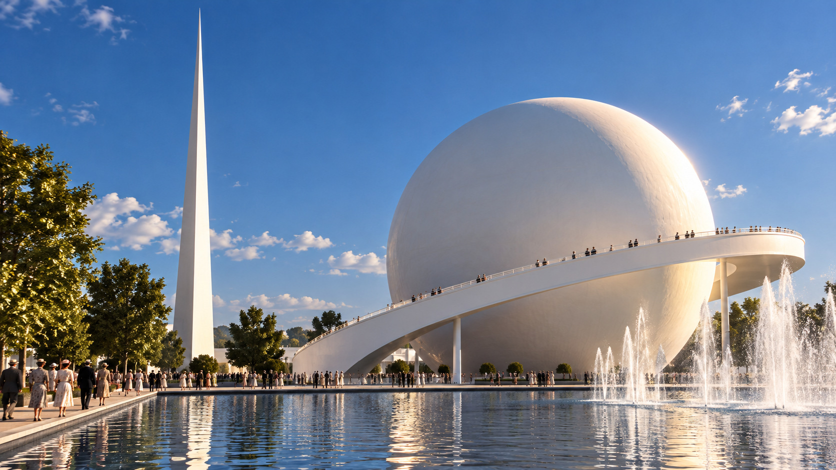
A slender needle, an immense sphere and a curving ramp made a remarkable proposition: the future could have a shape. At the center of New York's 1939 World's Fair, the Trylon and Perisphere traded historical ornament for a startlingly simple silhouette. They were more than a logo enlarged to architectural size. The sphere contained an experience that visitors could enter and look down into. [T1] [T2] [T3]
Inside was Democracity, a miniature planned community designed by Henry Dreyfuss. A central city stood amid green space and smaller settlements. Visitors surveyed the model from above, encountering an ordered version of tomorrow in which the relationships between town and countryside appeared legible at a glance. This was a designed exhibit, not a functioning town hidden inside an enormous white shell. [T2] [T4]
The journey mattered as much as the model. An elevated, sweeping ramp, the Helicline, carried visitors back toward the surrounding fair. The sphere, needle and ramp connected a distant view with a moving human viewpoint: a visitor could approach the symbols, disappear inside the exhibit and return to the crowds. Surviving photographs establish their arrangement without requiring a guess at the exact color of every projected interior effect. [T2] [T3]
The exhibition closed in 1940, and its great symbols were subsequently dismantled. The steel globe now associated with Flushing Meadows, the Unisphere, belongs to the different fair of 1964; it is not a surviving Perisphere. What vanished here was an unusually complete piece of architectural persuasion. Democracity offered one generation a future it could inspect from a viewing platform, while the surrounding forms made that promise visible across the fairgrounds. [T1] [T2]
06The Garden Above a Palace
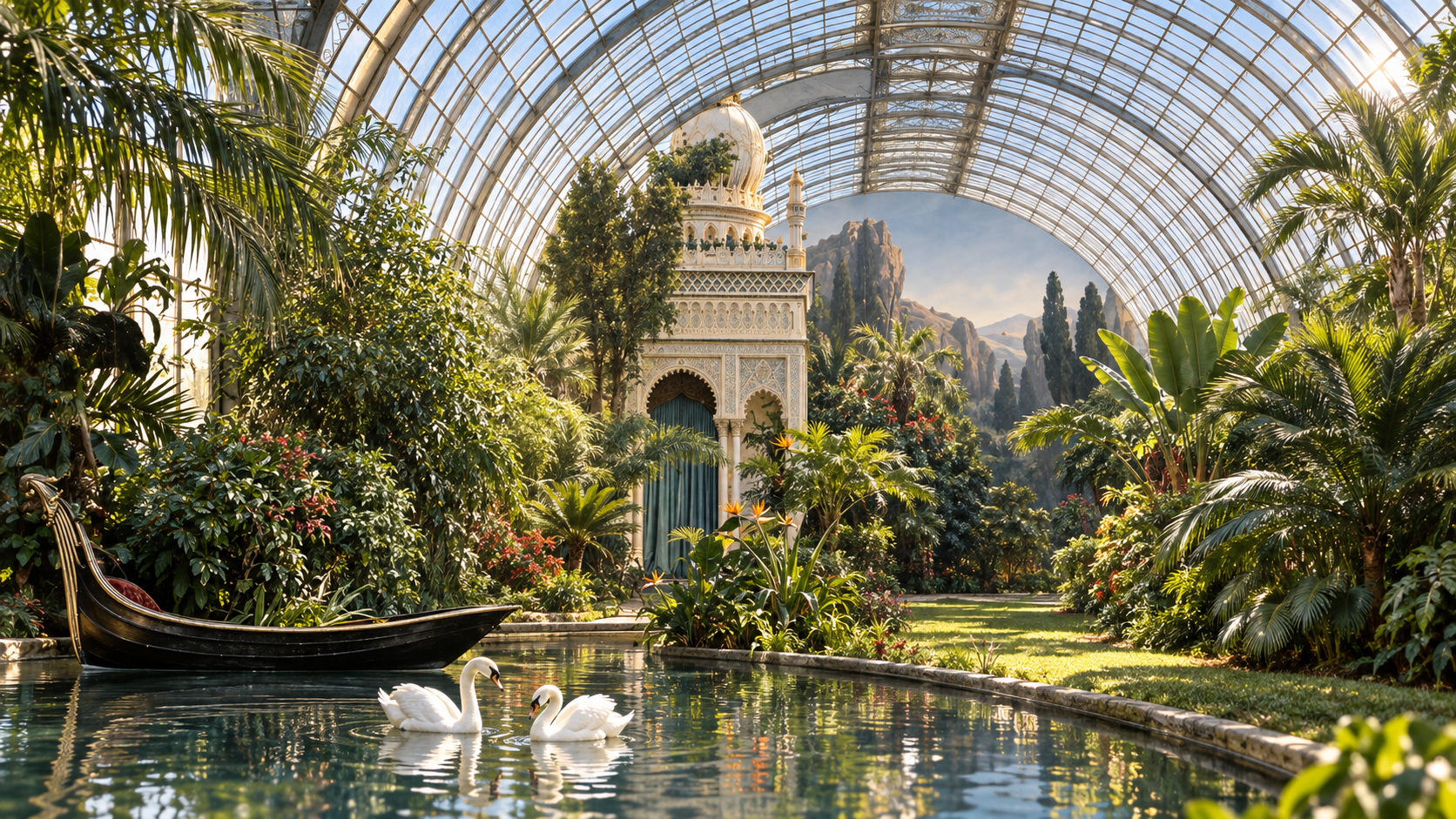
Of all the places to put a tropical retreat, a palace roof might be the least expected. Above the Munich Residenz, Ludwig the Second created a glass-and-iron Winter Garden, begun in eighteen sixty-nine. Plants and theatrical scenery transformed the enclosure into a private landscape. There was even an artificial lake. Joseph Albert's photographs are what make the idea so startling: you are looking at an actual constructed environment, suspended above a royal building. After Ludwig's death, the expensive garden was abandoned and eventually dismantled. The Residenz remains. The strange, sheltered world that once crowned it does not.
The garden was an intimate counterpart to the ceremonial rooms below. A glass-and-iron enclosure almost seventy metres long sheltered an artificial lake, tropical planting and carefully arranged scenery. Joseph Albert photographed both the interior and the palace exterior, allowing the setting to be understood from two very different viewpoints. The Residenz still stands, but its roof no longer carries Ludwig's extraordinary private landscape.
07The White Temple Above Uruk
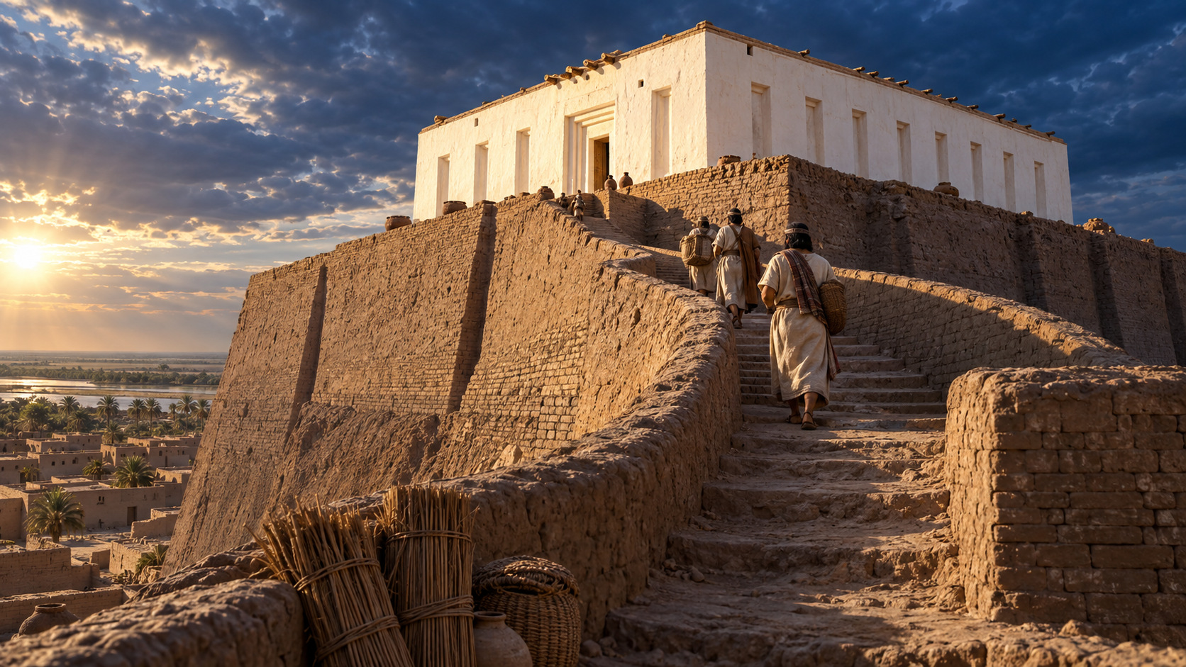
The White Temple's power came from its setting as much as its size. A compact sanctuary stood above the southern Mesopotamian plain on a substantial earthen terrace. White plaster and recessed walls gave the building a distinct presence, while the approach made reaching it an architectural experience. This is a Late Uruk monument of the fourth millennium BCE, among the early sacred buildings of an urban civilization. [U1]
A reconstruction commissioned in connection with German Archaeological Institute research draws on excavated walls, the building plan and a small ancient stone model. These support the central hall, wall articulation, approach and the relationship between sanctuary and platform. They do not settle every elevation: published alternatives include both one and two storeys. A complete roof should therefore be presented as a reasoned proposal rather than an excavated certainty. [U1]
The archaeological site has not vanished. Fragile temple masonry has required conservation, and the great supporting mass remains part of the landscape. What is lost is the complete sanctuary in use: pale walls rising above the terrace, a roof overhead and an approach leading to a working sacred building. There is no securely established single dramatic ending to turn that long architectural change into one event. [U2] [U1]
The White Temple belongs to the Anu area, distinct from the later Eanna ziggurat. Uruk contained different sacred buildings across a long history, not one interchangeable collection of ancient motifs. An archival photograph broadly identified as Uruk ziggurat ruins captures the weathered archaeological landscape. Against that surviving earth, the excavated plan and model make the former sanctuary newly imaginable: modest in its own footprint, commanding in its elevated position. [U1] [U2]
08Stockholm’s Industrihallen
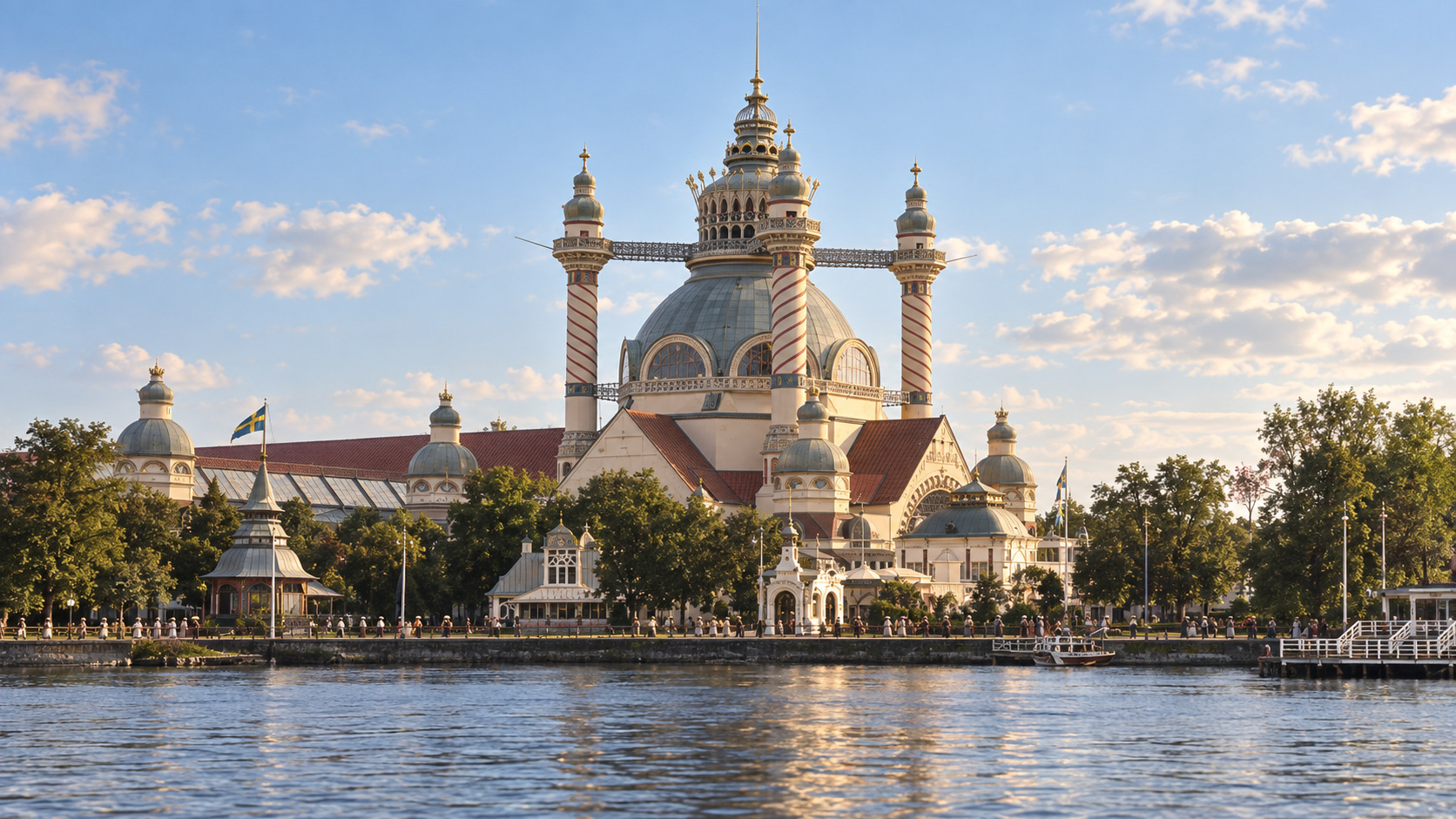
Stockholm's exhibition of eighteen ninety-seven gave industry an almost storybook silhouette. The Industrihallen gathered a great dome and towers into an enormous temporary hall. In photographs, the people below make its scale difficult to dismiss: this was a place crowds actually entered, not an unrealized drawing. It was made for an exhibition rather than a permanent life, and the grand hall disappeared after the fair. Another building from the exhibition, the separate machinery hall, had a different afterlife. Their stories should not be confused. The wonder here is this particular vanished enclosure, preserved in the careful detail of contemporary photographs.
Ferdinand Boberg and Fredrik Lilljekvist’s design placed industrial display inside an architectural spectacle. The dome and four towers could be appreciated from a distance; two towers also contained lifts that carried visitors up to look back across the exhibition. Inside, individual companies arranged their products in elaborate displays. The surviving exterior and interior photographs preserve both experiences: the palace-like shape across the water, and the dense succession of exhibits encountered by someone walking through its galleries.
09The Painted World Inside Mari
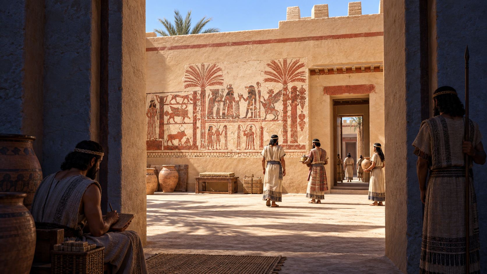
Mari's Great Royal Palace is most astonishing from within. Rather than one impressive front, it offered a connected world of courts, ceremonial chambers, stores, kitchens and apartments. Excavators counted roughly three hundred rooms and courts across about two hectares. That number alone suggests an institution sustained by many kinds of work: not simply a royal seat, but a network of spaces serving a functioning court. [M1]
The excavated plan preserves a striking sequence through Court 106, Room 64 and the throne room, numbered 65. The flowing-vase goddess belongs beside that approach, while surviving wall paintings reveal a ceremonial world of palms, divine figures and royal imagery. The Investiture Painting is a vivid witness, although the depicted king cannot securely be named Zimri-Lim. Its surviving colors bring the palace's earthen architecture an unexpected intimacy. [M2] [M4] [M5]
Around 1760 BCE, Hammurabi's forces looted and burned the palace. The mission's accounts differ slightly on the year, but agree on the violent end of the palace's royal life. Collapsed rooms preserved traces of decoration and extensive written records. The destruction ended a functioning courtly environment, but did not remove every wall or every clue to the people whose work sustained it. [M1]
Excavated courts and room relationships give this lost interior unusual definition. Surviving painting fragments add selected details, while complete upper floors, ceilings and furnishings remain uncertain. The palace's appeal lies in the movement between those spaces: a court opening ahead, a decorated wall encountered nearby, a ceremonial room beyond. Even in fragments, Mari shows that an ancient wonder could unfold through a building rather than announce itself in one overwhelming facade. [M2] [M3]
10Vienna’s Rotunde
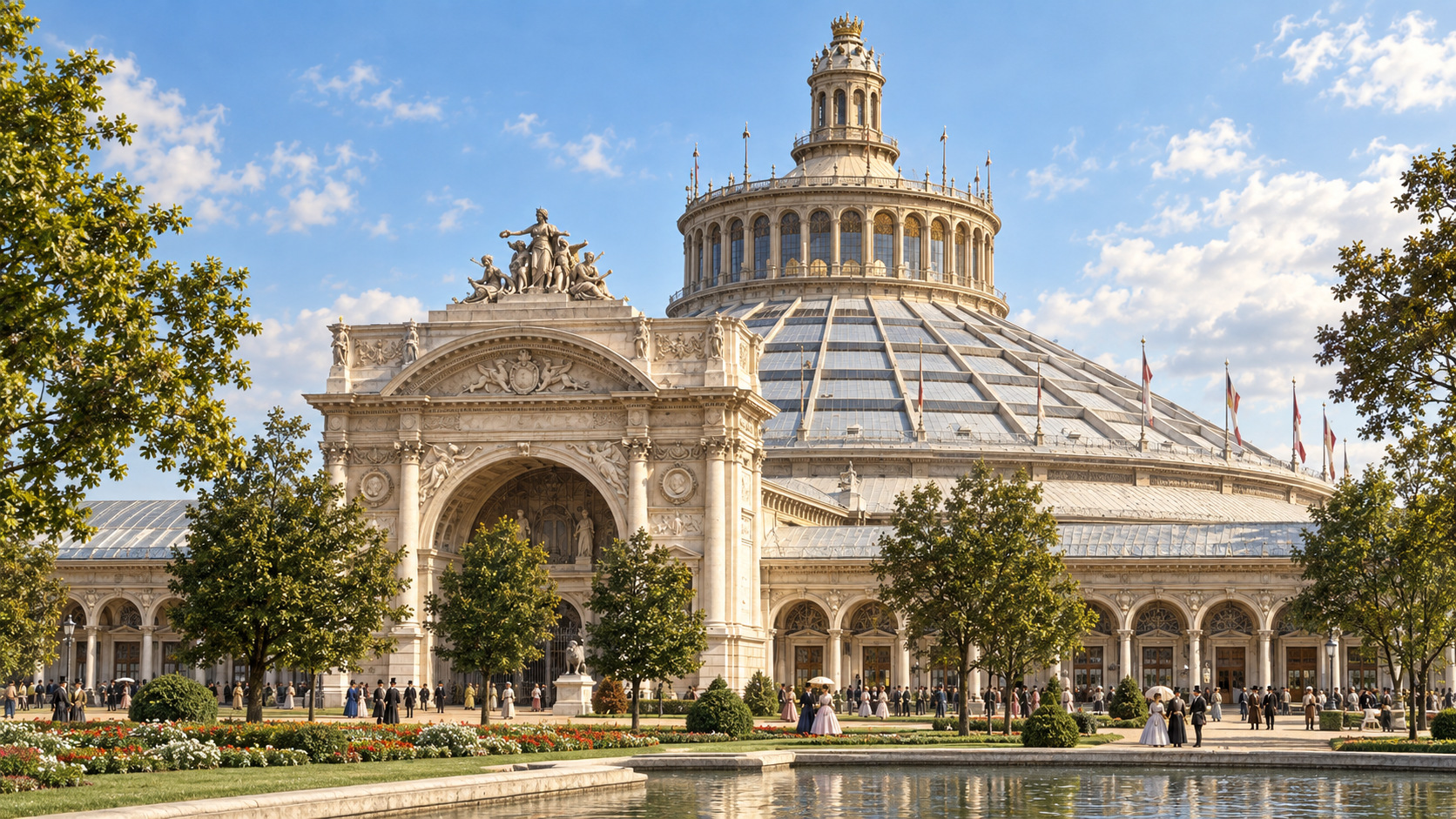
Vienna's Rotunde did not need a forest of towers to astonish visitors. One enormous dome was enough. Built for the world exhibition of eighteen seventy-three, it spanned roughly one hundred and eight metres. Inside, the eye had to travel a remarkable distance before finding the far side. Unlike many fair buildings, the Rotunde outlived its original exhibition and became a familiar part of the city. That survival makes its ending feel different. In nineteen thirty-seven, fire destroyed the great enclosure. A structure conceived to gather the world beneath one roof is now something we enter only through photographs.
Wien Museum records a dome 108 metres across and an overall height of 84 metres. Those two measurements describe different dimensions of the Rotunde’s ambition: a broad enclosure rather than simply a very tall landmark. The surviving photograph and lantern drawing bring the building into focus at opposite scales. One places the entrance beneath the immense crown of the roof; the other shows how that crown was shaped. The 1937 fire ended a public life that had lasted far beyond the 1873 exhibition.
11The Capital on a Fortified Platform
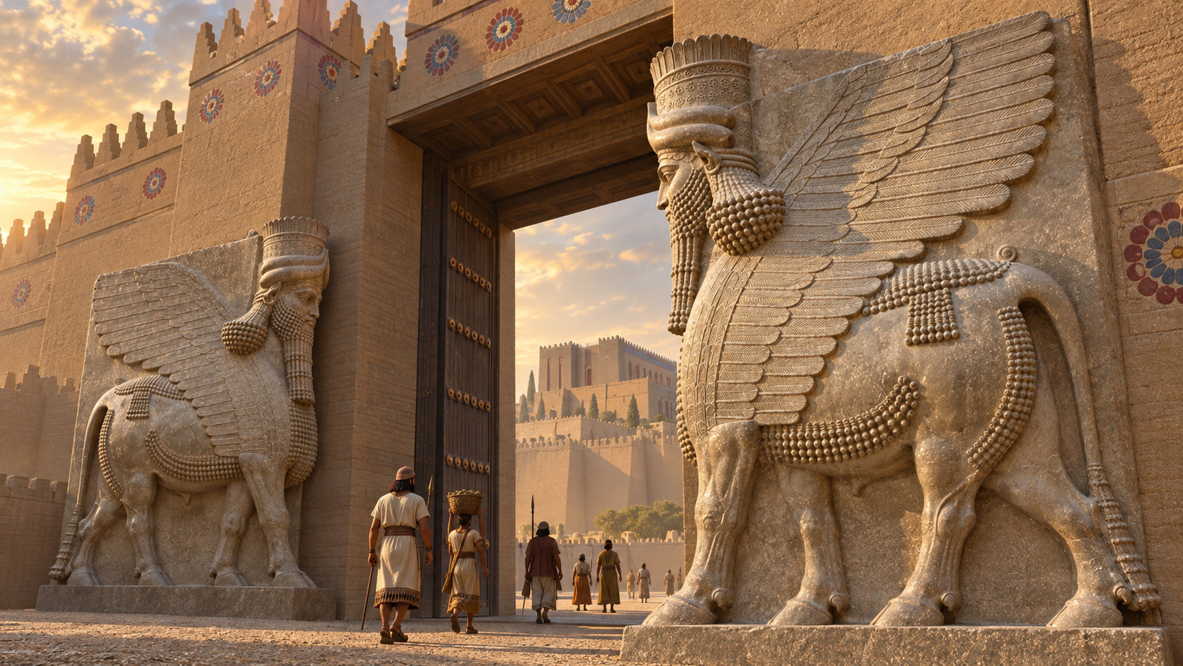
Dur Sharrukin was royal ambition expressed at the scale of a city. Sargon the Second established the Neo-Assyrian capital in the eighth century BCE, with palace buildings, temples and elite residences raised on a fortified terrace. The setting matters: it was not merely an ornate facade, but an elevated ensemble overlooking a lower town and the surrounding plain. [K1]
Guardians and decoration made that hierarchy visible. Colossal human-headed winged bulls marked important gateways, carved reliefs organized ceremonial imagery, and coloured bricks animated selected surfaces. Individual sculptures carry specific histories. The Louvre's guardian AO 19859 came from city gate three, not the palace throne-room entrance. A different excavated guardian documented by the University of Chicago belongs to that throne-room context; their different origins reveal how gateways across the city could express royal authority. [K3] [K4] [K5]
The palace was inaugurated in 706 BCE. Sargon died in 705, and his successor Sennacherib made Nineveh the capital. This abrupt change explains unfinished work, but the often repeated claim that the whole city was deserted after one year is too simple. Evidence for later partial occupation includes a seventh-century governor. The loss was of its intended role and eventual complete royal setting, not an instantaneous emptying of every house. [K1] [K2]
Excavated plans, recorded relief locations and surviving sculpture give the ensemble unusually strong architectural anchors. Full upper elevations, rooflines and lost towers remain less certain. This was an Iron Age Neo-Assyrian project, contemporary with the Archaic Greek world. Its distinctive force comes from a city conceived around an elevated seat of power, where the approach to royal buildings was already part of the message those buildings delivered. [K1] [K2] [K3]
12Nonsuch: The Palace Made of Pictures
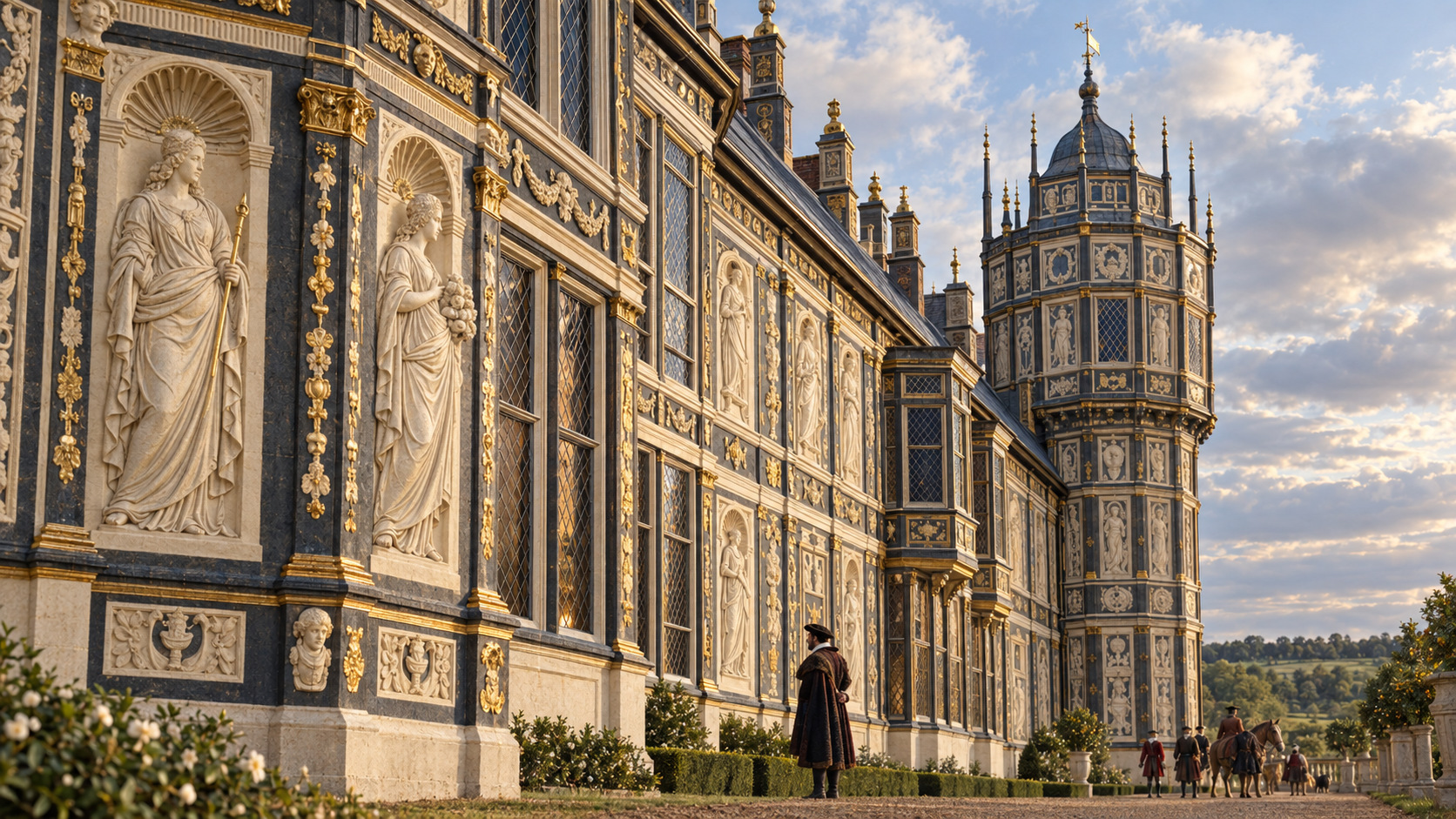
Nonsuch was a palace that asked visitors to look closely. Its effect came not from size, but from a skin of sculpted figures, carved slate and gilding. A familiar Tudor outline became something closer to an inhabited work of art. [N1] [N2] [N3]
Henry VIII began the palace in Surrey in 1538. The site had been occupied by Cuddington village, which was demolished for the project. Nonsuch was intended as a royal hunting lodge and an architectural showpiece, with adjoining courts, elaborate windows and projecting octagonal towers. [N1]
The richest decoration combined creamy stucco relief with dark slate borders. Classical emperors, gods, heroes and allegorical figures formed a programme of learning and royal ambition. Excavated slate preserves traces of gold and astonishingly practical evidence: French instructions showing where pieces should be fixed. [N2] [N3]
Contemporary pictures help recover the building's appearance. Joris Hoefnagel drew Nonsuch in 1568 during his visit to England; a later engraved view circulated in the great atlas of cities. Such images are valuable witnesses, though they do not reveal every panel or supply complete color measurements. [N4] [N5] [N6]
Most of the main palace was demolished between 1682 and 1688. Materials were sold, and the architectural ensemble disappeared. Buried foundations and recovered fragments survive, however, preserving evidence that the celebrated decorative surfaces were more than a visitor's extravagant description. [N1] [N2] [N3]
A reconstruction should therefore bring the surfaces near: relief casting shadows, dark slate framing pale bodies, restrained gold catching light. It should not inflate this hunting palace into a gigantic chateau. The missing parts remain interpretive; the remarkable combination of materials is grounded in surviving archaeology. [N1] [N2] [N3]
13Nan Madol: The Islands Built from Stone
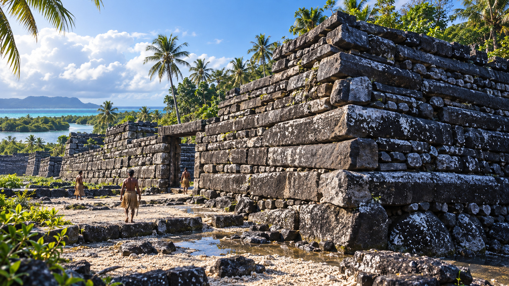
Nan Madol looks almost as if its builders stacked a forest made of stone. Long, naturally formed basalt columns cross one another in massive walls, while other enclosures incorporate rough boulders. The result is distinctive architecture, not a row of conventional palaces. [NM-UNESCO] [NM-IARII]
The complex lies beside Temwen Island, off Pohnpei in the Federated States of Micronesia. UNESCO describes more than one hundred artificial islets preserving chiefly residences, ritual places and tombs, with major remains dating between 1200 and 1500. Archaeologists emphasize that this was an exceptional ceremonial and administrative centre, not a densely populated everyday city. [NM-UNESCO] [NM-IARII]
Nan Dauas, also written Nandowas, is especially striking. Its monumental enclosures protected chiefly burials. The enormous basalt members were brought from elsewhere on Pohnpei; their arrangement makes the labour and skill immediately visible. Exactly how every heavy stone was moved should not be invented as settled fact. [NM-IARII]
The waterways need equal care. Modern photographs show water between the platforms, but a 2022 study reconstructed lower medieval sea levels and proposed that the monuments originally stood on dry land. A confidently flooded medieval Venice would conceal that uncertainty. [NM-SEFTON-2022]
Political importance declined after Saudeleur rule, and residential use had ceased by the 1820s. Yet the site retained religious and traditional significance. Its walls and archaeology remain; their conservation is threatened by vegetation, silting and storm effects. [NM-UNESCO] [NM-IARII]
The lost wonder is therefore the inhabited ceremonial landscape, not an entire civilization erased overnight. A reconstruction can restore a sense of occupation and scale, while photographs show the surviving stone and captions make the missing details honestly visible today. [NM-UNESCO]
14Sutro Baths
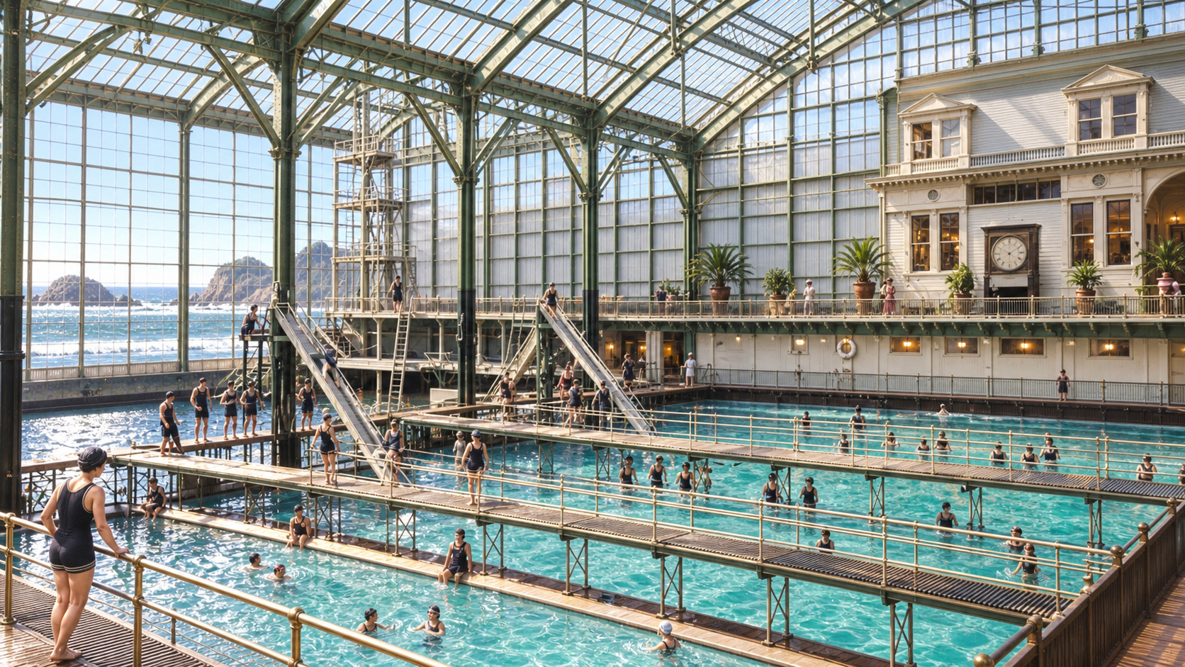
Look beyond the concrete ruins beside San Francisco's ocean and imagine a building filled with people, water and reflected light. Sutro Baths opened in eighteen ninety-six. Beneath its immense glass roof were swimming pools and galleries that made bathing into a public spectacle. An interior photograph is the real revelation: this was a whole indoor landscape, not simply a large swimming pool. Its disappearance came in stages. The baths closed, demolition began, and fire destroyed the remaining enclosure in nineteen sixty-six. The basins still mark the ground. What is missing is the bright, crowded world that once rose above them.
The baths combined swimming with spectatorship. Galleries surrounded the pools beneath a glass enclosure, and visitors could experience the spectacle without entering the water themselves. The National Park Service records seven pools in the original complex. Changing leisure habits and later uses preceded the building's decline. Today, the exposed concrete basins give an outline of the vanished indoor world rather than a complete picture of its height and enclosure.
15Chan Chan: A City Patterned with the Sea
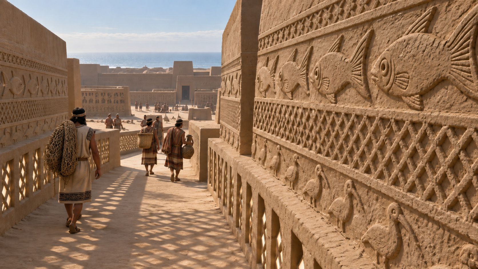
At Chan Chan, earthen construction became a language of pattern. The Chimú capital near Peru's coast combined extensive royal compounds with large courts, corridors and relief-covered walls. Fish, birds and netlike forms make its visual character immediately different from a palace whose impact depends on a grand stone facade. The landscape may appear dry and spare, but marine imagery gives the architectural surfaces a distinctive life. [C1]
UNESCO describes a monumental centre within a much larger city, with major palace compounds organizing its most imposing spaces. At Nik An, a main plaza, ceremonial patio, corridors and royal mausoleum give that scale a particular shape. Moving between large open courts and narrower passages would have made the earthen walls feel very different from the ground than they do in a distant panorama. [C1] [C2]
Chimú independence ended with Inca conquest during the fifteenth century. That political change should not become an invented single-night destruction of every wall. Chan Chan survives as an extensive archaeological site, with fragile earthen fabric requiring sustained care. The vanished subject is the inhabited royal environment, not the disappearance of all its material remains or of the people connected to its history. [C1]
Peru's conservation work at Nik An includes protective coverings, an important warning when using modern photographs. Roof frames above a visitor route are not automatically ancient architecture, and sharply defined reliefs may include conserved or completed surfaces. Reconstructing full roofs, room furnishings and crowds requires interpretation. The surviving layouts and motifs nevertheless offer a strong foundation for a distinctive scene: earth walls organizing space while the sea appears again and again across their surfaces. [C2] [C1]
16Fanghu Shengjing: A Garden Built as Paradise
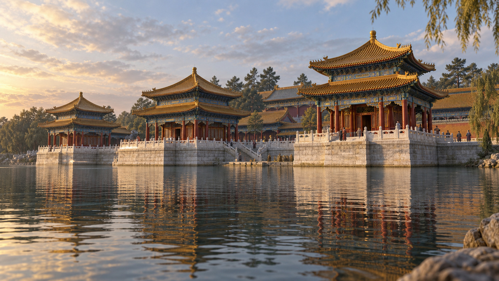
Fanghu Shengjing made architecture behave like a landscape. Beside Fuhai, a lake within Beijing's Yuanmingyuan imperial gardens, roofs, terraces and reflections formed a composition that could be admired across the water and explored at human scale. Ceremony, craftsmanship and landscape became one experience. [F1] [F2]
The official park account describes three great front pavilions, their white stone bases projecting into the lake, with further halls arranged symmetrically behind them. Yellow glazed tiles crowned the roofs. MIT's study identifies twelve major structures, with red buildings, blue and green decoration, and white marble balustrades. [F2] [F3]
This was also a temple garden. Its imagery drew on Daoist ideas of immortal mountains, while buildings behind the front pavilions housed Buddhist images. These were religious and artistic associations, not evidence that a supernatural island existed. [F1] [F2]
A court painting dated 1744 records the setting. The Bibliothèque nationale de France identifies it as scene twenty-nine of the imperial album, painted by Tangdai and Shen Yuan, with accompanying imperial verse written out by Wang Youdun. It preserves a contemporary vision rather than a modern reconstruction. [F1]
British and French forces looted Yuanmingyuan in 1860, and the destruction of the gardens erased Fanghu's timber ensemble. Its surviving site cannot recreate the experience of moving among the painted halls or seeing their roofs multiplied in the lake. [F4]
Yet the wonder is not wholly without material traces. Ruins and terraces remain, with later conservation visible in modern photographs. An interpretation can restore architectural relationships, color and human scale, while acknowledging that the painting is neither a measured plan nor a photograph of every lost detail. [F2] [F5]
17Shali: The Town Built Like a Cliff
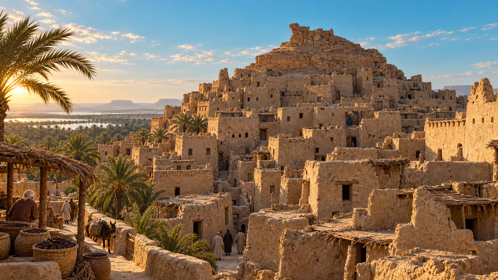
Shali's remarkable shape belonged to domestic life. Above the oasis of Siwa, closely gathered homes produced the appearance of an inhabited cliff. Their construction used salt-rich blocks and mud mortar, materials closely connected to the surrounding landscape. Its striking character comes from the relationship between the houses: compressed lanes, overlapping walls and small openings, rather than a symmetrical palace front or a row of isolated towers. [SHALI-FAO]
The loss began before the event most often used to explain it. The Egyptian heritage proposal hosted by FAO records departures from the crowded settlement during the nineteenth century. Three days of heavy rain in 1926 critically damaged the houses and accelerated that process. It is therefore misleading to describe a thriving, wholly intact town suddenly dissolving in one storm, or to imply that every resident and building disappeared together. [SHALI-FAO]
The old mosque and parts of the settlement remained, and later conservation helped make the ruins accessible. Egyptian heritage authorities and the European Union's account of the revival project document that continuing life. Modern Siwa survives around the older walls. Present-day photographs record those conserved walls and the living town around them, a very different scene from the crowded residential skyline before the rain. [SHALI-MINISTRY] [SHALI-EU]
The surviving walls still communicate Shali's material character and the close relationship between one home and the next. Complete roofs and upper floors are harder to recover with confidence. Yet the distinctive achievement remains legible without pretending that every missing room can be restored: a settlement whose dense domestic architecture produced a skyline as memorable as a monument. The ruins stand within a living oasis, not outside human history. [SHALI-FAO] [SHALI-MINISTRY]
18Tenochtitlan: The Capital in the Lake
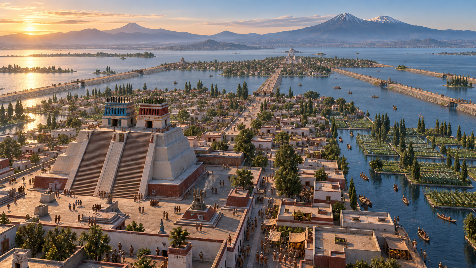
Tenochtitlan makes a city's infrastructure part of the wonder. Causeways crossed Lake Texcoco towards an island capital, while canals and canoes connected movement on water with life on built-up ground. The Mexica enlarged the original island through chinampas, supporting cultivation as well as houses and other buildings. These were reclaimed areas of land, not gardens drifting freely on rafts. The city depended on that relationship between water and construction. [T1] [T4]
At its ceremonial centre stood the Templo Mayor, repeatedly enlarged while retaining two summit shrines and a double stairway. Tlaloc's shrine lay to the north and Huitzilopochtli's to the south. The major causeways connected the city with Iztapalapa, Tlacopan and Tepeyac. Tlatelolco's great market belonged to the wider urban world, distinct from the sacred enclosure. Water routes, land routes, commerce and ceremony occupied related but different spaces. [T2] [T5] [T1]
In 1521, Spanish forces and Indigenous allies defeated the Mexica capital. Colonial rebuilding followed, reusing material and aspects of the earlier urban structure. The surrounding lake landscape was altered over a much longer period, not drained in a single moment. Modern Mexico City remains a living capital above that history, and excavation exposes parts of the older ceremonial centre within it. [T3] [T4]
The lost wonder is the pre-conquest lake city in its earlier form, not a vanished people or an empty modern landscape. Archaeology and institutional descriptions support the broad relationships, while exact household arrangements, complete roofs and the final skyline remain interpretive. Modern photographs of the conserved temple and its serpent sculpture are valuable surviving evidence, but they show exposed archaeological phases and later surroundings, not a complete photographic blueprint of Tenochtitlan before the conquest. [T2] [T3] [T4]
19The First Saltair
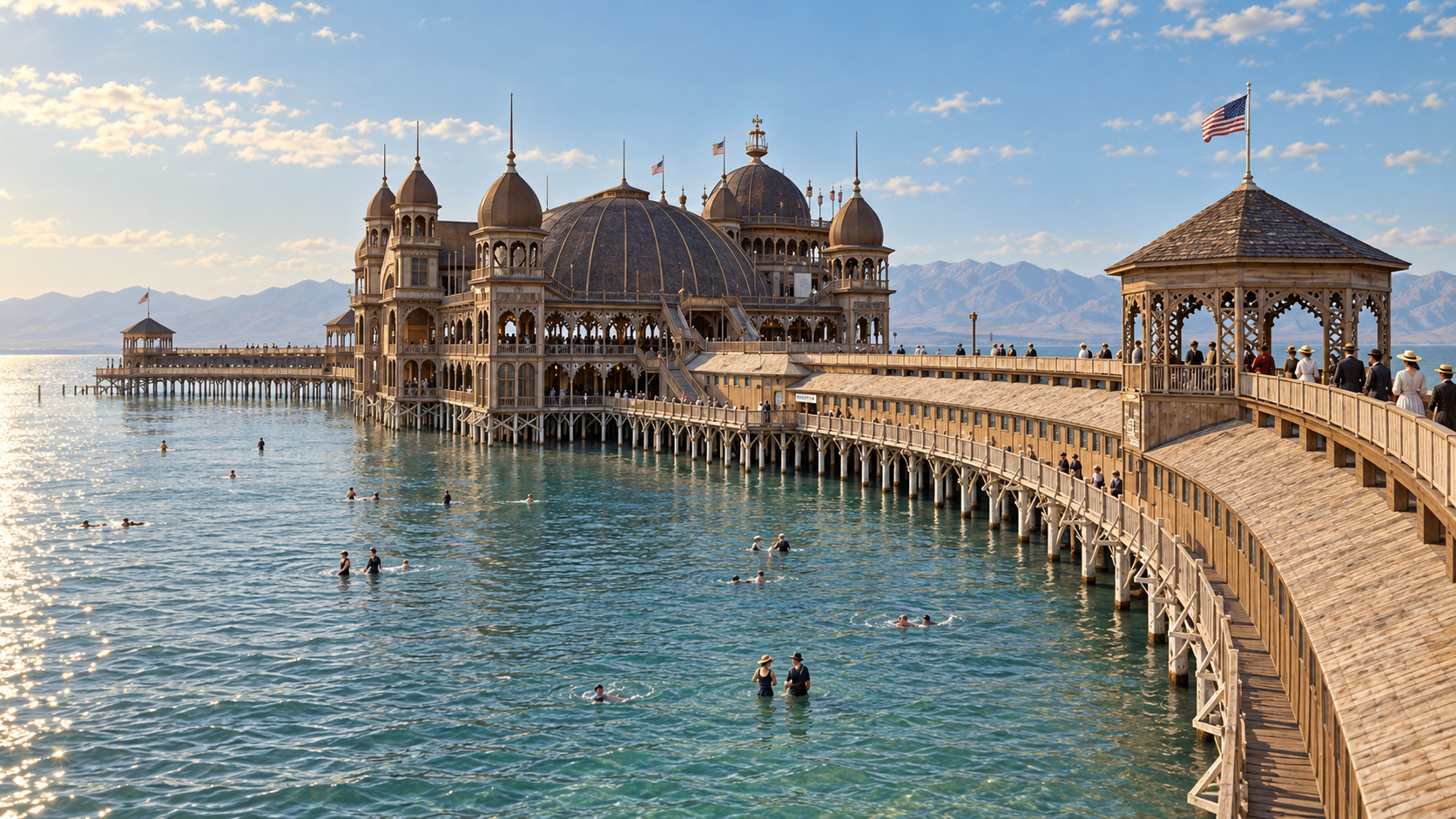
Out on Great Salt Lake, a forest of domes seems to float above the water. This was the original Saltair pavilion, opened in eighteen ninety-three. Its long pier turned a trip to the shore into a theatrical arrival, with the fantastic roofline waiting at the far end. Photographs make the scale wonderfully clear: small figures, open water, and an enormous pleasure pavilion where neither seemed to belong. In April nineteen twenty-five, fire destroyed this first Saltair. Other versions followed, with their own complicated lives. But the structure in these early pictures was gone. Even a place built for escape could not escape change.
The pavilion was connected to the shore by a long pier, making the approach part of the experience. William Henry Jackson's glass-negative photograph captures its domes, platforms and surrounding water around 1900. Later buildings inherited the Saltair name after the first pavilion's 1925 fire. The repeated name can disguise several different structures and losses, but the original photograph fixes this particular version in place.
20Buffalo’s Electric Tower
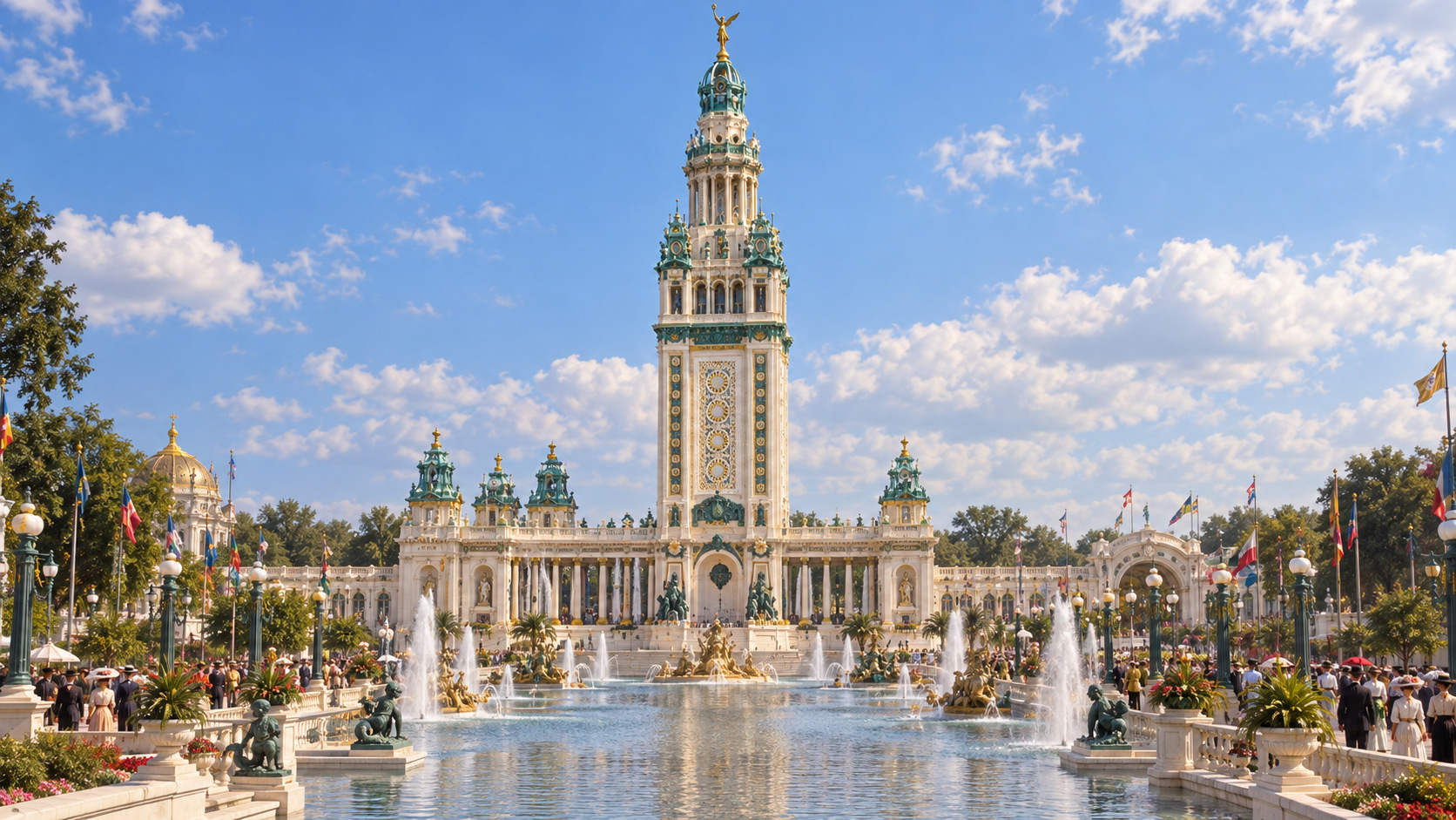
Buffalo's Pan-American Exposition gave electricity a tower of its own in nineteen hundred and one. By day, the Electric Tower was an elaborate monument above the fairgrounds. By night, electric illumination turned its outline into a performance. Photographs of the lit tower preserve a moment when light itself could make architecture feel like news. After the fair, demolition reduced it in stages; the statue came down before the last of the base. Buffalo's later downtown Electric Tower is a different building. The exposition tower had done its work for a season, then joined the vanished world its photographs still illuminate.
The end of the Electric Tower unfolded slowly. The Buffalo History Museum’s reconstruction from contemporary newspapers records demolition work beginning in March 1902, the summit statue falling that July, and roughly 50 feet of the base still standing in April 1903. A fair could close on a date; its buildings took much longer to disappear. Salvage transformed a celebrated illuminated skyline into reusable material. Buffalo’s later downtown Electric Tower continued the name and some of the visual association, but it was a separate 1912 building.
21Wright’s Imperial Hotel
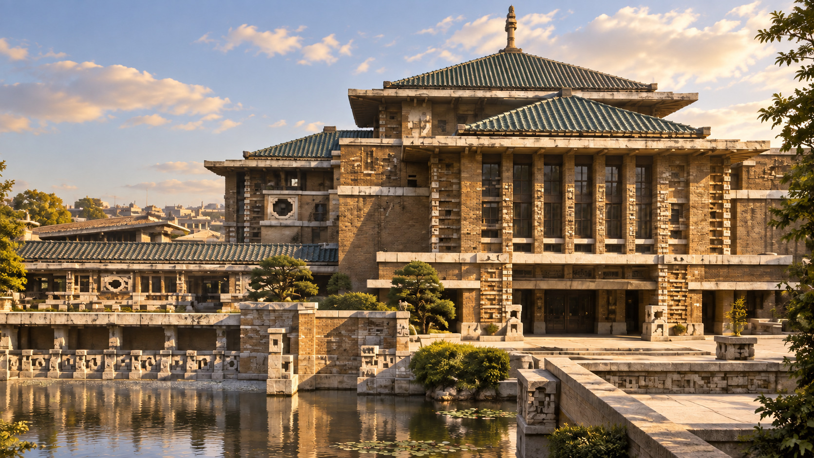
Frank Lloyd Wright's Imperial Hotel offered Tokyo something very different from a tower of anonymous rooms. Low terraces, pools, richly patterned surfaces and layered masonry made arrival part of the experience. In historical photographs, the entrance belongs to a much larger architectural landscape. That matters, because a visitor today can still see an important piece of it. After the hotel closed in nineteen sixty-seven, most of the building was demolished. Entrance and lobby sections were preserved at Meiji Mura. The fragment is extraordinary, but it is not the whole hotel. Sometimes preservation saves the doorway while the world beyond it disappears.
The preserved entrance and lobby at Meiji Mura give the Wright building a partial physical afterlife. They retain an encounter with its distinctive architectural language, but they do not reproduce the entire hotel of rooms, terraces and connected spaces. A Japanese photographic publication from 1937 records the operating hotel among the modern buildings of Tokyo. The original setting and the larger complex were lost when the hotel was replaced.
22The Château Above the Pacific

The Cliff House of eighteen ninety-six looks almost misplaced: an elaborate château balanced above the Pacific, with turrets and steep roofs rising from a rocky coast. Photographs and period color prints confirm that the improbable silhouette was real. It survived San Francisco's earthquake of nineteen hundred and six. Then, in September nineteen hundred and seven, fire destroyed it. That reversal is the heart of the story: surviving one famous catastrophe did not guarantee a long future. The later Cliff House carried the name forward in another building. But this short-lived coastal fantasy, so recognizable in old pictures, belonged to only eleven years.
The coast supplies the scale that makes the château so startling. Surf, people on the beach and distant rocks turn the building from an isolated silhouette into a place above a real shoreline. The selected 1899 photochrom was made through a historical colour-printing process rather than colour-film photography. The château survived the 1906 earthquake, but its destruction by fire in 1907 left it with a remarkably short life.
23Chicago’s Temporary White City
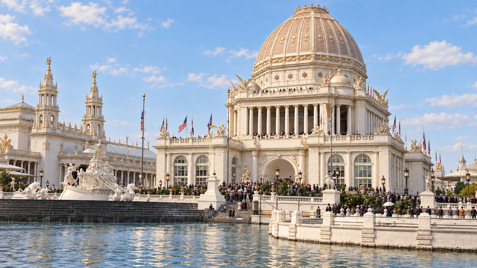
The Administration Building at Chicago's exposition of eighteen ninety-three looked ready to preside over a permanent city. Its enormous dome and classical surroundings gave the fair an air of authority, as if the buildings had already earned a place in history. Much of that grandeur was temporary construction, made to serve an extraordinary season. The building later burned as the fairgrounds were dismantled in eighteen ninety-four. Looking back, the photographs tempt us to mistake appearance for intention. This wonder was not simply a permanent monument that failed. It was an immense temporary stage, powerful enough that, long after it vanished, we still wish we could walk onto it.
Richard Morris Hunt’s dome stood above the administrative offices of the 1893 exposition, turning the running of the fair into a monumental presence. Its prominence survives in photographs and illustrations, including an opening-day view and a night scene. Contemporary reporting from 1894 describes the dome burning during the destruction of the former fairgrounds. The later survival of Chicago’s former Palace of Fine Arts belongs to another building; the Administration Building’s own architectural life ended with the temporary city it helped organize.
24Bam: The Fortress Made of Earth
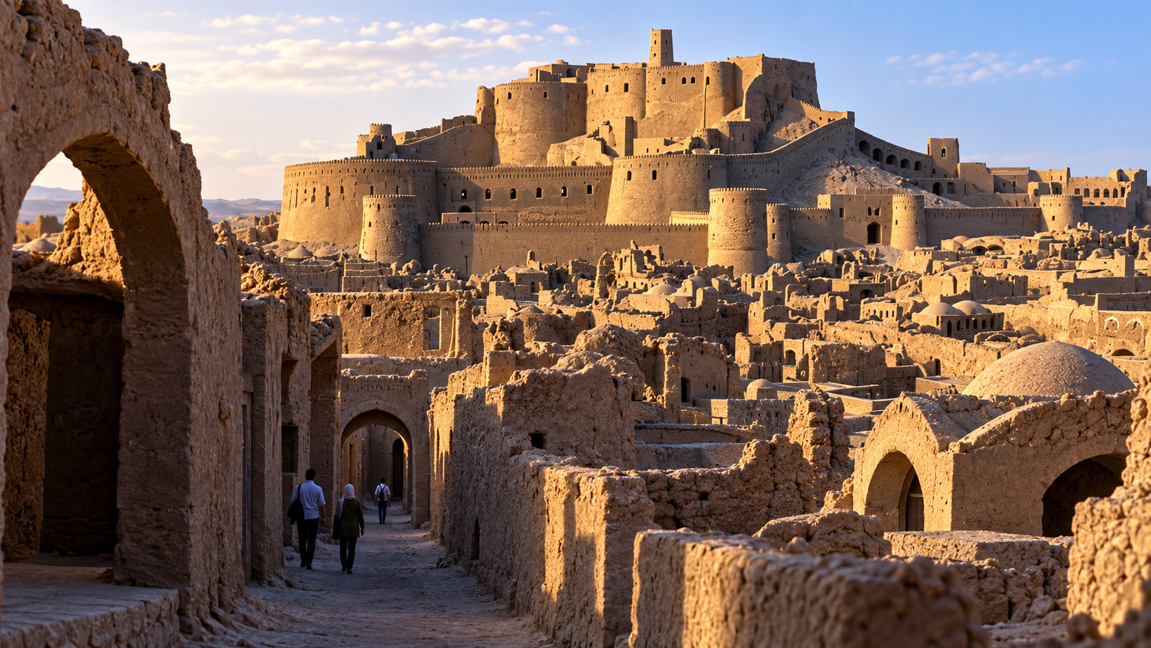
Arg-e Bam's visual force comes from a town rising into a fortress. Residential fabric, domes and lanes gather beneath an elevated citadel, with rounded towers and ramparts giving the ensemble a powerful outline. Houses, a bazaar, a mosque, baths and a caravanserai belonged to the fortified settlement. Seen together, these buildings turn a commanding silhouette into a place shaped for varied forms of everyday life. [BAM-NII]
On 26 December 2003, an earthquake devastated the citadel and damaged the surrounding city. Upper walls and much of the governor's quarter collapsed. The pre-earthquake skyline, however, was not an untouched ancient original. Substantial restoration had already shaped what visitors saw and photographers recorded. That history is essential when describing which architectural form was lost and which material is genuinely older. [BAM-NII] [BAM-UNESCO]
UNESCO's assessment distinguishes surviving fabric from the damaged and restored upper ensemble. Conservation and reconstruction followed the earthquake, drawing attention to earthen building practice as well as the recovery of particular forms. Removal from the World Heritage in Danger list in 2013 reflected improvements in stabilization and management; it should not be translated into a claim that every building had been completely rebuilt. [BAM-UNESCO] [BAM-2013]
An April 2000 photograph shows the high citadel above partly roofless town fabric. It is a revealing before-view precisely because damage and restoration already belonged to the place. The earthquake changed that layered ensemble profoundly, but did not make its history begin or end in a single morning. Bam's continuing recovery carries forward both surviving earth walls and the knowledge needed to maintain architecture made from such vulnerable material. [BAM-PHOTO] [BAM-UNESCO]
25Festival Hall and the Cascades
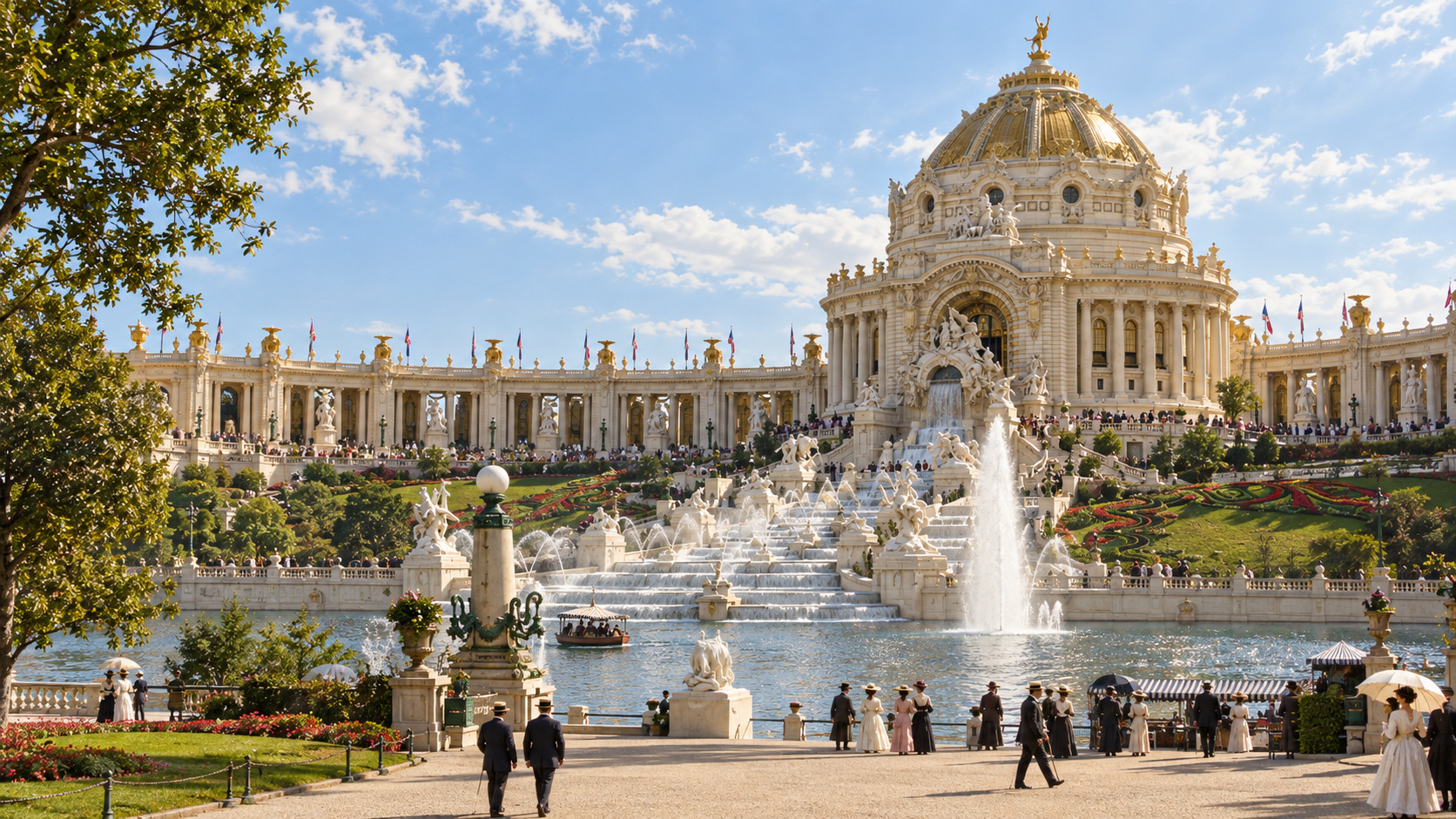
Water spilled down the Cascades beneath Festival Hall at the Saint Louis world's fair of nineteen hundred and four. The arrangement made the building and landscape work together: a domed hall above, moving water below, crowds between the spectacle and their cameras. Night views added another transformation as electric light traced the scene. After the exposition, the temporary hall was removed. Its great organ had a different future, eventually becoming part of the enlarged Wanamaker organ in Philadelphia. The setting disappeared while an important part of its sound moved on. Not every lost building takes everything inside it into the past.
The organ’s second life was almost as remarkable as its first setting. Purchased in 1909, the fair instrument travelled to Philadelphia in 13 freight cars and was first heard in the Wanamaker store in 1911. It was subsequently enlarged, so the later instrument was more than an untouched relic. Festival Hall itself appears in the exposition’s official salvage contract alongside terraces, statuary and other structures. The documents place demolition and preservation beside each other: one immense public room disappeared while its instrument found another.
26The Wawona Tunnel Tree
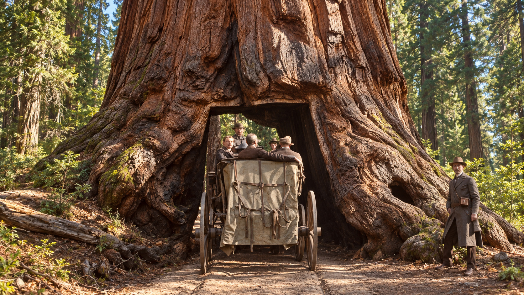
A vehicle inside a giant tree is an extraordinary photograph. It is also a record of a decision. In eighteen eighty-one, a tunnel was cut through Yosemite's Wawona Tree, turning a living giant into a drive-through attraction. Visitors could pass through its trunk and carry away a picture that seemed to prove nature had made room for them. When it finally fell during the winter of nineteen sixty-eight to sixty-nine, the tree was about two thousand one hundred years old. Heavy snow and saturated soil played a part; the cut had weakened it. The fallen trunk remains, but the living gateway in the photographs does not.
Underwood & Underwood's published stereograph records President Theodore Roosevelt and companions passing through the tree in 1903. The setting is Yosemite's Mariposa Grove, not Sequoia National Park. NPS identifies the tunnel, snow and soil conditions as contributing factors in the collapse. Calling the tree lost refers to the standing living sequoia; the fallen trunk remains in the grove.
27The Palace That Could Not Outlast Winter
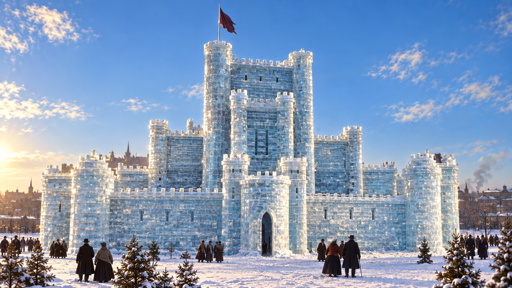
A fortress rose in Saint Paul from a material that could not promise permanence. In 1886, the city's first Winter Carnival placed an ice palace in Central Park. A surviving photograph shows a high central mass behind lower battlemented walls, round corner towers and an arched entrance. Courses of ice turned the familiar grammar of fortification into something startling. [SP1] [SP3] [SP4]
After dark, electric illumination offered another way to experience the building. Littleton Public Library preserves a Kilburn stereograph catalogued under its original title as the 1886 palace by electric light. The effect depended on the meeting of old architectural forms with modern lighting and frozen water. This was a castle made for public wonder, its theatrical power inseparable from its unlikely material. [SP2]
There was a business proposition behind the enchantment. The carnival's organizers wanted visitors to experience Minnesota's cold as an attraction rather than a deterrent. Their history describes drawing on Montreal's carnival and its expertise in ice palaces. The new structure gave that invitation a physical center: something to approach, photograph and remember together. [SP3]
The first palace disappeared, but the idea did not. Central Park hosted new palaces in 1887 and 1888. Those were replacements, not the original surviving under new decoration. An ice building's seasonal vulnerability made recurrence more important than preservation. Saint Paul's carnival continues; the lost wonder is this one particular architecture, briefly assembled from winter itself. [SP3] [SP4]
Reconstruction can follow the identified 1886 photograph's silhouette. Exact lighting colors, unseen details and incidental visitors remain interpreted; the old photograph is evidence, not a record of the generated scene. [SP1] [SP2]
28Cincinnati’s Old Main Library
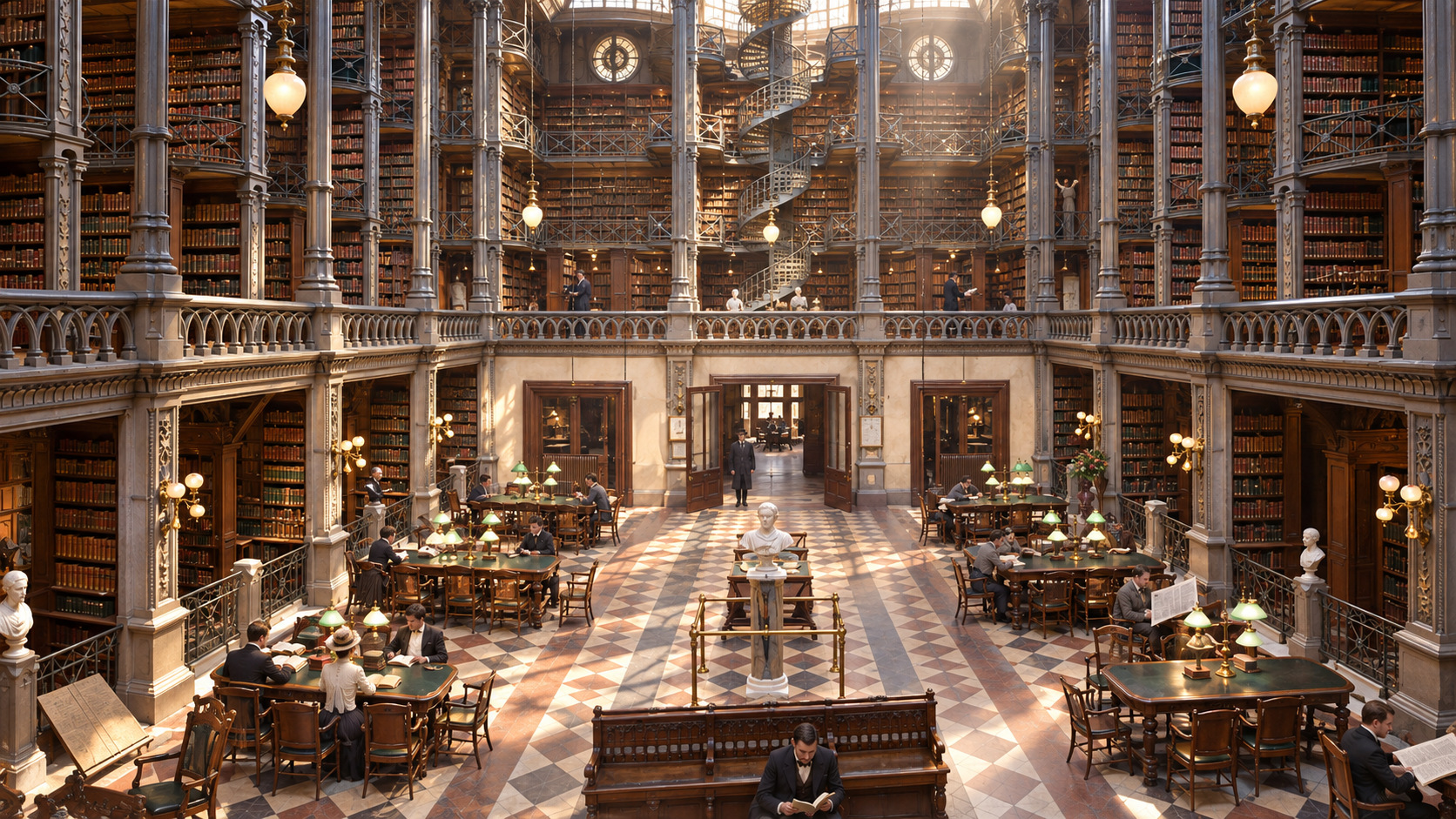
Imagine coming here just to borrow a book. Cincinnati's old main library rose around its readers in tiers of galleries, with slender columns and daylight falling through the roof. The architecture made an ordinary public service feel almost ceremonial. And this was a working library, not a private collector's fantasy. People browsed its shelves and read the newspapers beneath that extraordinary structure. When a new main library opened in nineteen fifty-five, the institution moved on and the old building was demolished. The collection had a future. The room did not. Sometimes a lost wonder is not a palace, but somewhere anyone could walk in.
The old library contained more than its celebrated central hall. A separate 1899 photograph shows readers with newspapers in a quieter room, alongside the archive's image of the soaring book galleries. Together they reveal a working public institution rather than an ornamental shell. When a new main library opened in 1955, the institution continued in a different building, leaving photographs as the most immediate record of the earlier interiors.
29The Buddhas Inside the Cliff
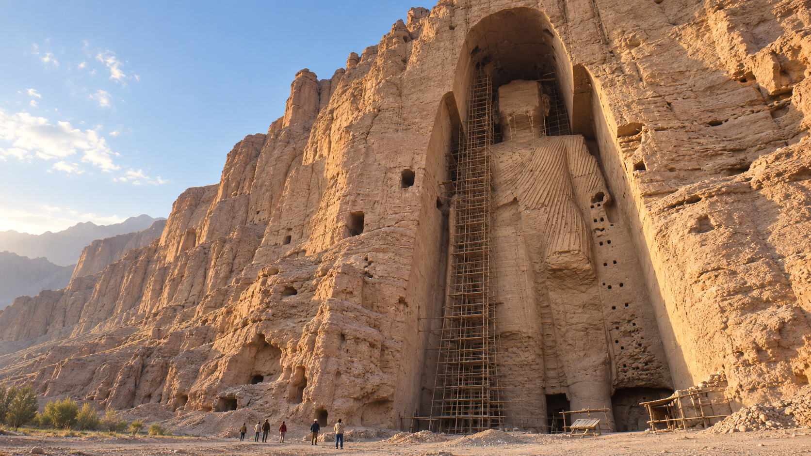
The two monumental standing Buddhas at Bamiyan were inseparable from their cliff. Deep niches framed the figures, while caves and painted sanctuaries extended the religious environment around them. The effect was not that of a portable statue placed against a dramatic backdrop. Rock, sculpture, architecture and painting worked together, with the scale of a person below making the carved figures seem still more extraordinary. [BY1]
The surrounding archaeological landscape is part of the subject, not empty scenery. UNESCO's property record treats the valley as a connected cultural landscape with substantial surviving remains. The images selected for this chapter document the standing figures before their final destruction, rather than claim to restore their original ancient faces, colours or complete surface treatment. Earlier weathering and damage belong to that photographic record. [BY1] [BY4] [BY5]
In March 2001, the Taliban deliberately destroyed both monumental statues. Describing that act accurately does not require saying that all of Bamiyan vanished. The great niches remain, together with caves, paintings and fragments. Their survival is fragile: UNESCO's conservation reporting distinguishes stabilization and mural work from the return of two complete Buddhas to the cliff. The remaining place is neither empty nor secure from further loss. [BY1] [BY2] [BY3]
Two photographs from 1977 offer sharply different encounters with the standing figures. One looks up at the larger Buddha, with scaffolding and earlier damage visible; another looks downward beside the smaller figure towards a tiny visitor near its feet. Neither shows a pristine ancient original. Together they preserve something more specific: the immense human-made presence of the Buddhas in their niches before their deliberate destruction, within a landscape that still needs care. [BY4] [BY5] [BY3]
30Alexandria’s World of Scholars
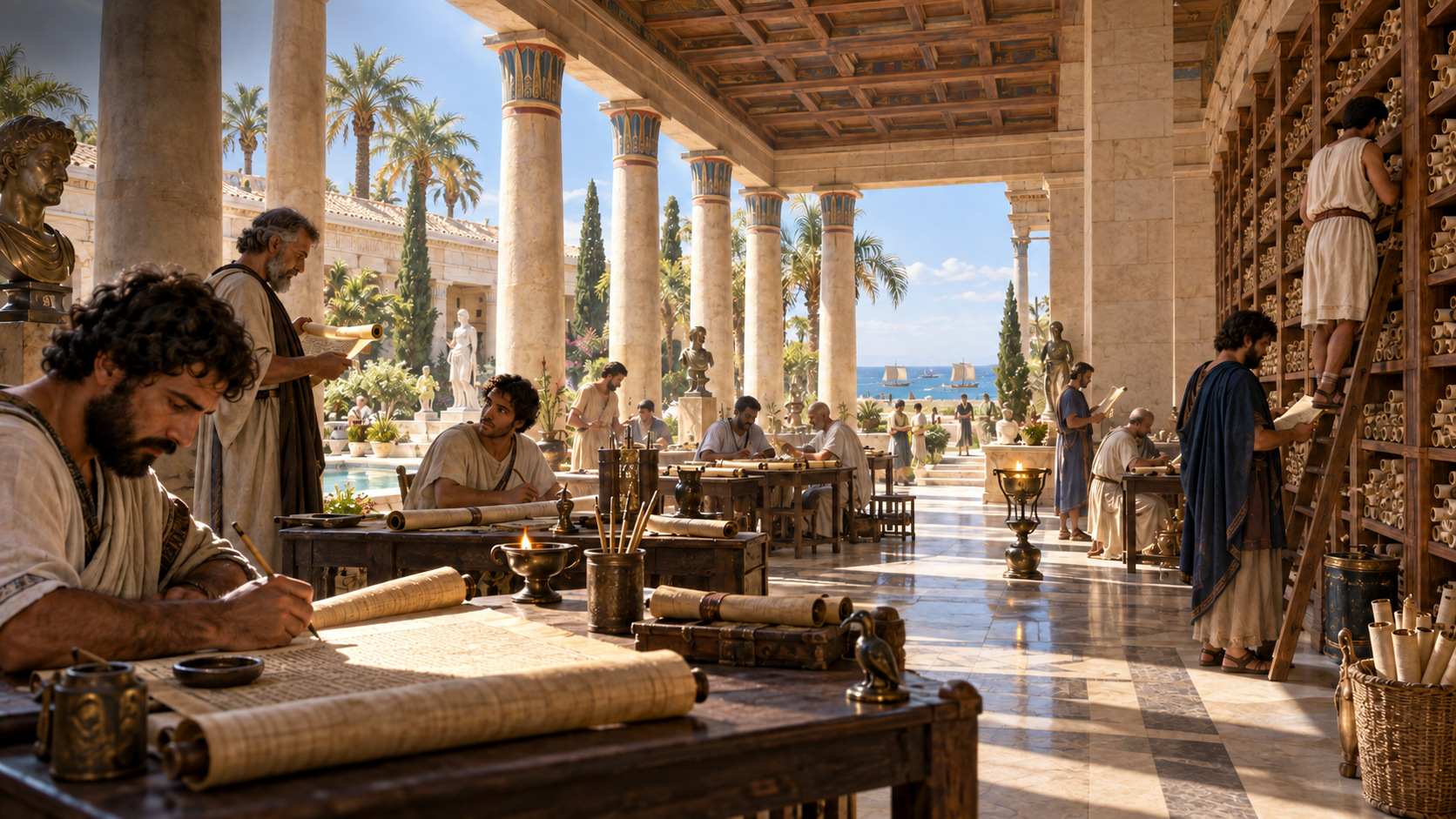
Alexandria's scholarly world comes into focus through its shared spaces. Under the early Ptolemies, royal patronage supported a library and the community called the Mouseion. Learned people could devote their days to texts within the royal quarter. The institution's extraordinary achievement was to make sustained intellectual work a part of the city's physical life: reading, discussion and meals belonged to a common environment. [A2] [A3]
Strabo supplies a valuable glimpse of that environment. In his Geography he locates the Mouseion within the royal palaces and describes a walking area, an exedra or place for seated gathering, and a common dining hall. Walking, sitting and eating belong to an ordinary human day. Here they suggest how scholarship could be shared beyond the act of consulting a text, without giving us a floor plan of the library itself. [A5]
Alexandrian scholars compared versions of literary works and helped shape texts inherited by later readers. In a culture of handwritten books, a difference between copies could demand patient attention. A familiar poem was also an object of argument and investigation. The rolls mattered, but so did the habits of people using them: the willingness to compare, question and spend time over a difficult passage. [A3] [A6]
Its architecture cannot be recovered precisely, and its ending is uncertain. The surviving evidence offers glimpses of a cultural space rather than an intact architectural portrait. A Ptolemaic papyrus from Hiba shows period writing material, not a rescued library scroll; the Serapeum is a separate sanctuary. What makes the lost scholarly complex compelling is the connection between those unrecoverable rooms and texts that continued to be read far beyond Alexandria. [A1] [A2] [A5] [A6] [A7]
A picture can make a lost place look permanent. The lights are still on. The doors are still open. Someone is still crossing the square. Behind each scene is a change the people who knew that place could not necessarily see. These thirty wonders are gone, or changed beyond the form we remember. The question is not only what the past lost. It is what we are deciding to keep.
Sources & further reading
Direct sources are grouped by story. Image credits, collection links and rights advisories appear beneath each image.
01 · Treasure Island's Vanished Fair
02 · The Silver Tree That Served an Empire
- William of Rubruck, account of the Mongols: the Khan's palace at Karakorum
- Karakorum, the Capital of the Mongol World Empire
- Jan Bemmann and Susanne Reichert, Karakorum, the first capital of the Mongol world empire: an imperial city in a non-urban society
- Christina Franken, Die Grosse Halle von Karakorum: excavation monograph synopsis
03 · The Palace of Electricity
04 · The Bedroom That Opened onto a Painted City
- Cubiculum (bedroom) from the Villa of P. Fannius Synistor at Boscoreale
- Met Collection API object247017
- Boscoreale: Frescoes from the Villa of P. Fannius Synistor
- Roman Frescoes from Boscoreale: The Villa of Publius Fannius Synistor in Reality and Virtual Reality
- Open Access at The Met
- The Villa of P. Fannius Synistor at Boscoreale: A Virtual Tour
- Met photograph DP143704: bedroom M installation
- Met photograph DP-24001_001: bedroom M side-wall detail
05 · The Future Inside a Sphere
06 · The Garden Above a Palace
07 · The White Temple Above Uruk
08 · Stockholm’s Industrihallen
09 · The Painted World Inside Mari
10 · Vienna’s Rotunde
11 · The Capital on a Fortified Platform
12 · Nonsuch: The Palace Made of Pictures
- Nonsuch Palace and associated remains, NHLE 1017998
- Slate, NON59/S293, Tudor 1541–1547
- Panel, stucco panel
- Joris Hoefnagel: Nonsuch Palace, 1568
- Hogenberg after Hoefnagel, 1582, Y,5.153
- Nonsuch Palace from Civitates Orbis Terrarum, 1582, 61.650.2
- Commons: Nonsuch Palace, Hoefnagel drawing of1568
- Commons: Nonsuch Palace, period print after Hoefnagel
13 · Nan Madol: The Islands Built from Stone
- UNESCO: Nan Madol, ceremonial centre of Eastern Micronesia
- International Archaeological Research Institute: Monumental Architecture of Nan Madol
- William S. Ayres, University of Oregon: Nan Madol archaeological field research
- Implications of anomalous relative sea-level rise for the peopling of Remote Oceania
14 · Sutro Baths
15 · Chan Chan: A City Patterned with the Sea
16 · Fanghu Shengjing: A Garden Built as Paradise
17 · Shali: The Town Built Like a Cliff
18 · Tenochtitlan: The Capital in the Lake
19 · The First Saltair
20 · Buffalo’s Electric Tower
21 · Wright’s Imperial Hotel
22 · The Château Above the Pacific
23 · Chicago’s Temporary White City
24 · Bam: The Fortress Made of Earth
25 · Festival Hall and the Cascades
26 · The Wawona Tunnel Tree
27 · The Palace That Could Not Outlast Winter
- Winter Carnival ice palace, Central Park, St. Paul — Allen Swain, 1886
- Kilburn Brothers Stereographic Slide Index — Box 16, no. 5147
- The Origin, The Legend & The History of the Winter Carnival
- Central Park, St. Paul
- Historical photograph: Allen Swain, Ice Carnival Views, St. Paul, 1886. Minnesota Historical Society, MR2.9 SP9.1 1886 r25 original; negative 47518. Public-domain historical photograph. Exact catalogue record. Separate MNHS reproduction policy; no new museum license or permission grant is claimed.


![[F5]](https://commons.wikimedia.org/wiki/File:Yuanmingyuan_Fanghu_Shengjing_20120715.JPG)
![[BAM-PHOTO]](https://commons.wikimedia.org/wiki/File:Bam_(2000)_01.jpg)
![[BY4]](https://commons.wikimedia.org/wiki/File:BamyanBuddha_Larger_1.jpg)
![[BY5]](https://commons.wikimedia.org/wiki/File:BamyanBuddha_Smaller_2.jpg)

