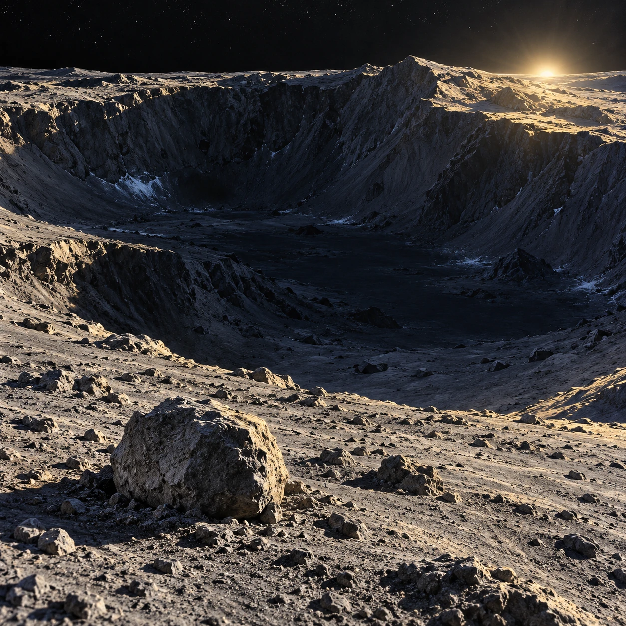
At the lunar poles, sunlight skims the terrain at a low angle. A crater rim can catch the light while part of the floor remains permanently shaded. Such places may preserve water ice—but darkness alone does not establish that every shadow is a suitable cold trap.
The useful question is thermal and temporal. How warm does the surface ever become, which volatile is being considered, and how long must it survive? A cold trap is a physical environment, not merely a black area in a photograph.
The Moon’s geometry makes unusual shadows
The Moon’s small axial tilt allows some polar depressions to avoid direct sunlight for very long periods. Their temperatures are still influenced by scattered sunlight, infrared radiation from surrounding terrain, conduction, and the changing illumination of nearby surfaces.
A permanently shaded patch can therefore be warmer than another permanently shaded patch. A deep crater surrounded by warm slopes receives a different radiative environment from a small protected hollow elsewhere. Shadow and temperature are related, but they are not interchangeable maps.
Hayne, Aharonson, and Schörghofer’s micro-cold-trap study explicitly models the relationship between shadow sizes and thermal stability. It finds that small-scale shadows can contribute meaningful cold-trap area while also noting that many permanent shadows at lower latitudes are too warm for long-term water-ice accumulation.
Survival depends on temperature through time
Ice can sublimate directly into vapor in the Moon’s near-vacuum. The rate depends strongly on temperature. A brief warm interval can matter disproportionately, so an average temperature may hide the part of the history most important for survival.
Different volatile substances have different stability requirements. A location suitable for one ice is not necessarily cold enough to retain every more volatile compound over the same timescale. Burial depth, the properties of the regolith, and local exchange processes further affect persistence.
NASA’s LRO frost study compares thermal and reflectance evidence. Its emphasis on the hottest conditions rather than a simple average illustrates why a cold-trap assessment needs a temperature history.
Evidence comes in different forms
| Observation | Useful inference | Important limit |
|---|---|---|
| Hydrogen enrichment | A hydrogen-bearing component may be present | Hydrogen alone does not identify every molecular form |
| Temperature compatible with ice stability | Ice could persist under the modeled conditions | A suitable trap need not contain a deposit |
| Water-related spectral signature | Supports a particular chemical interpretation | Abundance, depth, and spatial mixing still need analysis |
| Bright, cold surface patches | Can support a frost interpretation with other data | Brightness alone is not a unique ice detector |
The strongest account combines independent measurements and asks whether their footprints and depths match. Two datasets can concern the same region while sampling different surface layers or spatial scales.
Small shadows change the inventory
A boulder or small crater can cast a shadow far below the resolution of a continent-style map. Micro-cold-trap research asks how many such features exist, how their temperatures behave, and how much area they add collectively.
This is a scale problem. One small patch contributes little area, but an enormous number of patches may matter. The estimate still depends on surface roughness statistics and the thermal model, so a mapped potential area should not be presented as a measured volume of water.
NASA’s surface-shadow research account explores how local roughness affects water behavior. The practical insight is that the ground’s geometry can matter at scales smaller than the image that first attracted your attention.
A two-patch thought experiment
Imagine two permanently shaded patches with the same average temperature. PatchA varies only slightly, while patchB has brief warmer episodes and otherwise stays colder. Their water-ice survival can differ because sublimation does not respond linearly to temperature.
The example supplies no numerical survival time; calculating one requires a vapor-pressure relationship and a model for the actual surface. Its purpose is to show why averaging first and applying a strongly nonlinear process afterward can give a misleading answer.
Now give the patches identical temperatures but different water-delivery histories. One may be empty and the other contain frost. Thermal suitability describes storage potential. It does not establish whether the supply ever arrived or remained undisturbed.
Water elsewhere does not erase the polar story
NASA’s explanation of water detections distinguishes molecular water on sunlit terrain from earlier polar evidence. The phrase “water on the Moon” covers several forms, abundances, and environments, not lakes hidden just beyond every ridge.
LADEE-related research on meteoroid-released water shows that impacts can mobilize water into the thin lunar exosphere. Supply, migration, trapping, release, and loss form a cycle that is still being investigated.
That cycle complicates the idea of a single ancient delivery event. Different deposits may record different sources and histories. A cold-trap sample can therefore be valuable as an archive as well as a possible future resource.
As a map exercise, outline one permanently shaded region, then add a separate boundary for modeled water-ice stability. Do not force the outlines to match. Add a third layer for an actual compositional detection. Their overlap is more informative than any layer alone, and a blank region can mean missing coverage rather than a confirmed absence of ice.
Read a polar map before imagining a mine
Identify whether a map shows illumination, maximum temperature, hydrogen, inferred surface ice, or a modeled stability zone. Then check its resolution and date. A small bright pixel and a large potential cold area are not equivalent resource estimates.
Actual accessibility also depends on terrain, deposit concentration, depth, mechanical properties, and operating temperatures. The presence of water-related evidence is not enough to establish that extraction is straightforward or that every shadowed crater has the same material.
The most useful image to carry away is a rough landscape under grazing light. Its shadows are a patchwork of different thermal histories. Somewhere within that patchwork, molecules can linger long enough to become a record of how water reaches and leaves an airless world.
Sources and a next step
- Hayne et al.: micro cold traps on the Moon
- NASA LRO: thermal and reflectance evidence for frost
- NASA: roughness and surface shadows
- NASA: distinguishing lunar-water detections
- NASA: meteoroid impacts and released lunar water
Continue exploring art, ideas, and unexpected connections at Incoprea.