The long stones at Nan Madol can resemble enormous logs laid across one another. Look beyond that striking wall and the setting becomes even more remarkable: a network of constructed islets and waterways beside Pohnpei, in the Federated States of Micronesia. The architecture is also a landscape.
Understanding it requires several kinds of evidence. Geology explains the material's natural shape. Archaeology investigates its selection, movement and placement. Pohnpeian histories and continuing authority connect the remains to people and institutions. The story grows stronger when these questions are kept in conversation.
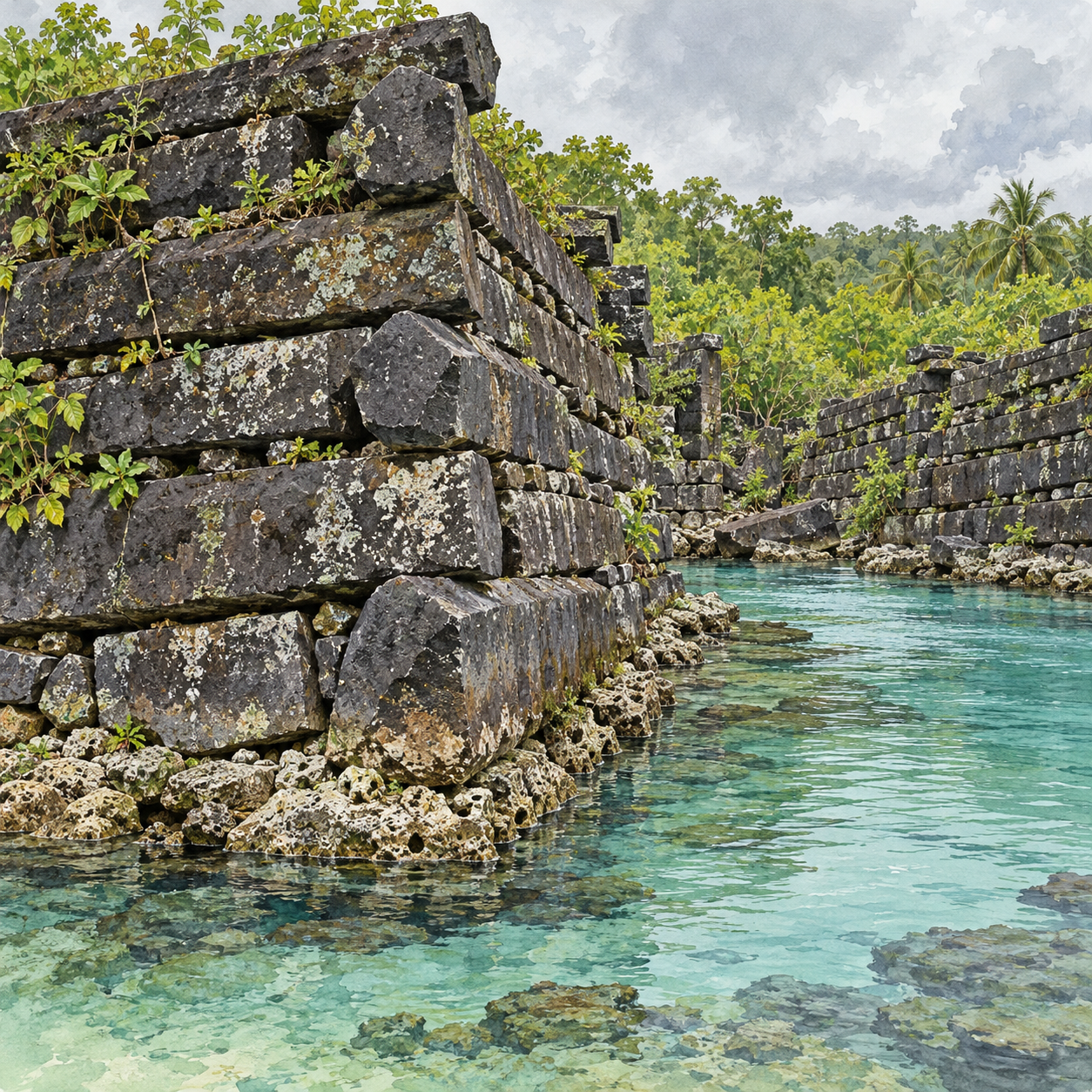
Begin with the spaces between the walls
UNESCO describes more than one hundred constructed islets off Pohnpei's southeast coast, containing residential, ceremonial and mortuary remains associated with the Saudeleur dynasty. The site's monumental development is broadly placed between the thirteenth and sixteenth centuries. That description concerns a complex that changed over time, rather than one building erected in a single campaign.
Waterways are part of its organisation. They separate spaces and connect them. A close photograph of masonry can make the complex appear to be one massive enclosure; a plan or a broad view reveals a sequence of distinct places. The difference is rather like seeing one room's wall and then discovering the surrounding building.
The International Archaeological Research Institute's account emphasises the specialised role of the centre: high-status residence, religious activity, administration and burial. It cautions against imagining an ordinary town. “City on the water” is a memorable phrase, but it can import assumptions about shops, streets and everyday populations that need separate evidence.
Natural columns, deliberate construction
Basalt can fracture into columns as lava cools and contracts. The resulting shapes supplied a useful building material, but they did not arrange themselves into perimeter walls. Builders selected pieces, brought them to the site and placed them in a composition with corners, entrances and differing orientations.
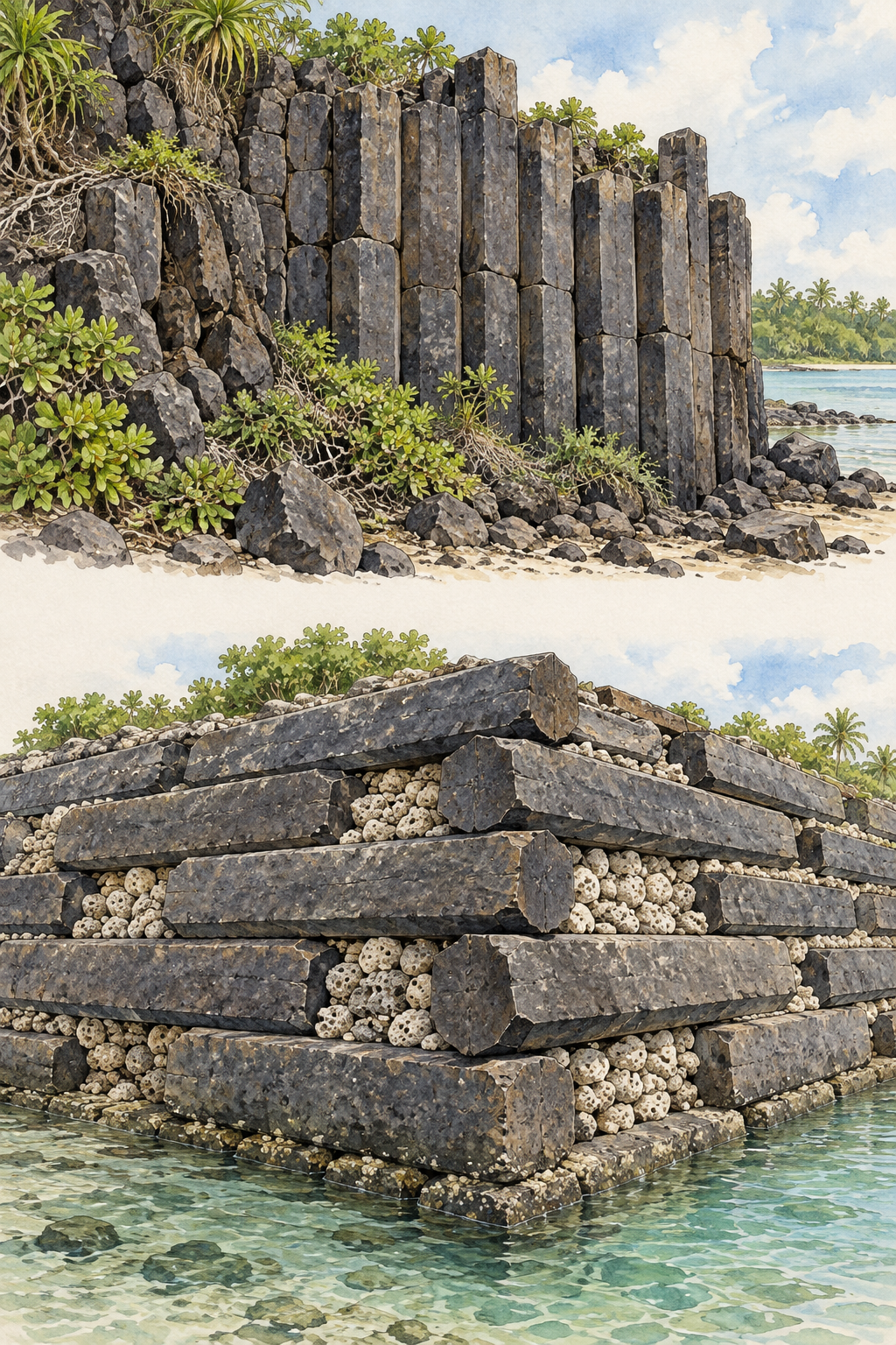
The comparison illustration separates geological formation from architectural assembly. Use actual site photographs to study the latter. Look at a corner where stones change direction. Even without calculating the weight of a block, you can see that position and relationship matter as much as shape.
Large-scale construction also implies coordination. Materials, labour and access had to come together. A wall makes the result visible, while the acts of planning and organising are harder to recover. That gap invites research into social relationships rather than unsupported claims that local people could not have achieved the work.
Two scientific questions with different answers
A 2016 study by Mark McCoy and colleagues combined geochemical sourcing of basalt with uranium-thorium dating of coral associated with a major tomb. The chemistry connected architectural stone with volcanic sources on Pohnpei, including material from the other side of the island. The coral results placed important building activity around the late twelfth and early thirteenth centuries.
The study's strength comes from combining evidence that answers different questions. A chemical relationship helps investigate where a stone came from. A dated coral sample, interpreted in its archaeological setting, helps investigate when part of a structure was built. Neither supplies a complete transport diary.
| Evidence | Question it addresses | What still needs investigation |
|---|---|---|
| Stone chemistry matches an outcrop | Where the material originated. | The route, equipment and stages of its journey. |
| Coral in a construction context is dated | Chronology of a particular building event. | How it relates to earlier and later phases. |
| A wall corner preserves its arrangement | How stones were positioned in that place. | The complete sequence of lifting and assembly. |
Try reversing the questions. Could stone chemistry alone establish the date? Could one dated sample identify every quarry? The mismatches show why a combination of methods is more persuasive than a single impressive measurement.
The site has more than one beginning
IARII's investigations describe occupation on natural sand islets before the great basalt monuments, and artificial-islet construction before their main monumental phase. A date associated with a conspicuous tomb cannot simply become the founding date for everything at Nan Madol.
This is a common difficulty when reading archaeological headlines. The oldest occupation, the first artificial platform, the beginning of a dynasty and the building of a surviving wall may be separate events. A good chronology identifies which event a date is meant to represent.
The 2016 study is particularly useful because its argument names the sampled materials and their architectural contexts. Readers can follow the movement from a measurement to a historical interpretation. Precision is meaningful when it is attached to a specific question, not used as a decorative guarantee of certainty.
Look across the lagoon, then return to the living place
Use UNESCO's site photographs for a two-view exercise. In a wide view, trace water around one islet. In a close view, follow the alternating stones at a wall corner. Describe how the waterways organise separation and connection, then how the stones organise enclosure.
UNESCO also recognises Nan Madol's continuing relationship to Pohnpei's traditional authority. Its cultural meaning did not end when particular buildings ceased to be occupied. Access, interpretation and conservation should remain connected to the people for whom the place continues to matter.
Preservation adds another reason to examine the water. Siltation and vegetation growth can affect channels and structures. The landscape is changing, and masonry cannot be protected by treating the lagoon as an attractive background. Nan Madol is most impressive when stones, water, history and present responsibilities remain visible together.