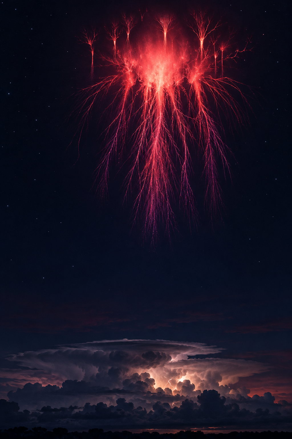
Most of us look downward for lightning: a bright branch reaches from cloud toward land, followed by thunder. But some storms also trigger an electrical display far above their cloud tops. For a few milliseconds, red tendrils appear high in the atmosphere, resembling a luminous jellyfish or an upside-down forest.
These events are called sprites. The playful name fits something so elusive that eyewitness reports long preceded convincing images. They are real physical phenomena, although a photograph can make their duration and visibility seem much greater than a person would experience.
The storm reaches beyond the clouds
Sprites belong to a family called transient luminous events: brief atmospheric glows associated with thunderstorm electrical activity. They form high above ordinary weather, often around 80 kilometers in altitude, after lightning changes the electric conditions below.
The reddish light is associated with nitrogen in Earth's upper atmosphere. Sprites can include diffuse bright regions and fine branching structures extending downward and upward. They are not solid objects, and their jellyfish-like appearance does not imply an animal-shaped cloud hovering over a storm.
Related phenomena have different forms. ELVES can appear as rapidly expanding luminous disks, while jets extend upward from storm regions. The family resemblance is electrical, but these names do not all describe the same event.
A discovery helped by looking sideways
In 1989, University of Minnesota researchers testing a low-light camera accidentally captured the first credible video evidence of sprites. That lucky recording helped launch a field of research into displays that are difficult to observe routinely.
Sprites are brief, and cloud cover can hide the view from below. Their association with storms does not mean the best vantage point is underneath one. A distant view over a storm can expose the clear sky above it. Images from aircraft and orbit have supplied additional perspectives.
NASA's Spritacular citizen-science project was developed to connect photographers' observations with researchers. Accurate times and locations help scientists compare an image with lightning records and other atmospheric information. An attractive photograph becomes more useful when its circumstances are recorded carefully.
Familiar air, unfamiliar questions
Scientists still investigate why sprites take particular shapes, how often they occur and how they interact with the broader atmosphere. Their connection to a lightning event is the beginning of an explanation, not the end of every question.
There are also hints of related events on other worlds. Juno observations at Jupiter were interpreted as evidence consistent with sprites or ELVES. A different atmospheric composition can change the expected color, reminding us that the same broad electrical process need not look identical everywhere.
For an observer on Earth, the striking thought is simpler. A thunderstorm is not confined to the dark cloud we can see. Its electrical influence can briefly light a much higher region, revealing an invisible connection between everyday weather and the edge of space.
Sources and further reading: NASA: Spritacular and the science of sprites; NASA: Sprites and ELVES, on Earth and at Jupiter.
Explore more creative curiosities at Incoprea.




